Cape Town Landfills
In February 2023, Delta Scan, along with our strategic partners, initiated the monthly auditing of Cape Town Landfills. This project has seen tremendous success throughout the year and continues into 2024.
Delta Scan has been focusing on this endeavor for some time. Merely utilizing the latest technology isn’t sufficient; it’s imperative to comprehend the technology, understand its implementation, and interpret the captured data effectively. The client has expressed immense satisfaction with Delta Scan’s capability to capture two landfill sites in a single day with remarkable accuracy and efficiency. As well as having issued full audit reports within 48 hours.
Before engaging in this contract, one of the major topics of discussion was the considerable improvement in information quality. A turnaround time achieved by employing aerial photogrammetry and aerial LiDAR was also discussed, in contrast to traditional surveying techniques. However, the client noted that previous aerial operations, conducted before Delta Scan’s involvement, raised concerns regarding the quality of reporting. Those reports often failed to meet the standards of those generated through traditional methods and were frequently inaccurate.


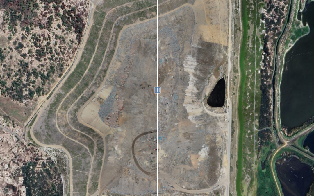
Our projects success relies massively on experienced drone pilots, expert ground control and master technicians. But the key feature in reporting is the hosting and analysis tool which the client has at their disposal on Delta Cloud. From Delta Cloud, all captures including historical are hosted on a mapped system, showing precise location and high-resolution detail. The specialist tools allow us to run completely autonomous volumetric calculations to understand activity on site, and simple to use measuring tools to understand heights of features, minimum and maximum slopes etc. Along with the measuring tools, Delta Cloud gives the client the ability to compare all the historical data, using a slider function for visual changes, but also various techniques to show change over time using heat maps.
Project Details:
- Deployments to date: 12 (once a month)
- Report deadlines missed: 0
- Hectares captured in a day: 420
