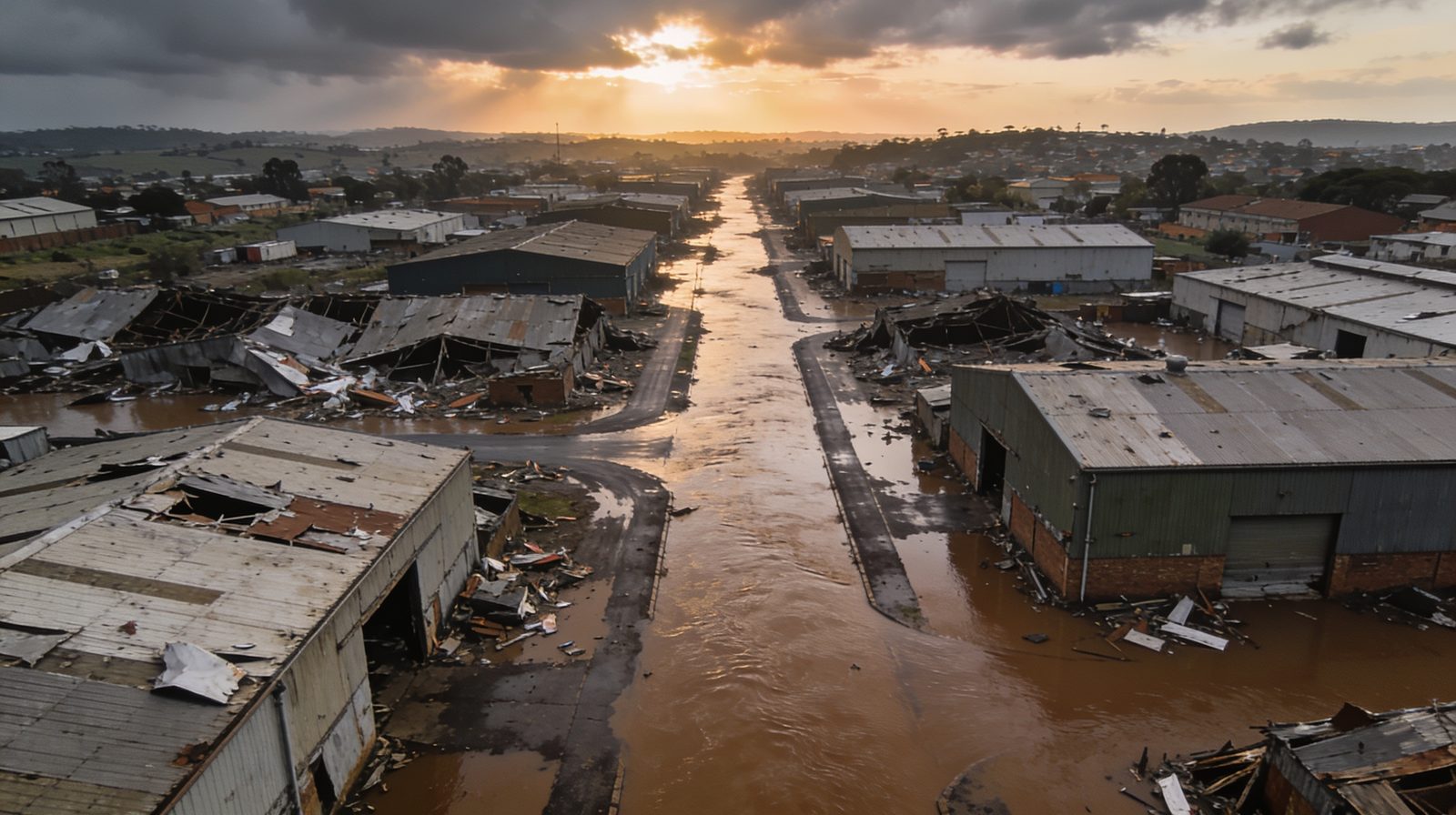
When a property is hit by a flood, a fire, an explosion or a severe storm, the most valuable evidence for your insurance claim starts disappearing almost immediately. Water recedes and leaves waterlines that dry out. Debris is cleared for safety. Damaged structures are propped or demolished before anyone has measured them. By the time a loss adjuster arrives, the scene that supports your claim has already changed. An accurate, independent record of the damage as it actually stood is what carries a claim, and any later dispute, through to settlement. This is exactly where structured insurance loss adjusting support makes the difference.
This guide sets out how to document flood, fire and storm damage properly, what most property owners miss, and when to bring in independent engineering capture.
Why the first record decides your claim
An insurer settles against evidence, not memory. The stronger and more objective your record of the loss, the less room there is for the claim to be reduced, delayed or contested. The problem is timing. Making a site safe and starting reinstatement cannot always wait for the claims process, so the physical evidence is disturbed within days. Once debris is cleared or a wall comes down, that condition cannot be recreated. Anything you capture before clean-up begins is effectively impossible to reproduce later, which is why the first hours and days matter so much.
What to document, and when
Aim for a complete, dated and consistent record rather than a handful of dramatic photographs. Cover the whole property, not only the worst-hit areas, because an insurer will want to see the full extent of the loss as well as the areas that escaped it.
In the first hours, if it is safe to do so
- Wide shots of every affected room, elevation and roof area, then close-ups of specific damage.
- Waterlines, scorch and smoke patterns, cracking, and any leaning or movement, before they are cleaned or covered.
- Serial numbers, model plates and contents before they are moved or discarded.
- Date and location metadata left switched on, so the record is verifiable.
Before clean-up or repairs begin
- A full walk-through record of the property in its damaged state.
- Anything a contractor is about to remove, prop or demolish to make the site safe.
- Damaged services such as electrical boards, geysers, roofing and ceilings.
- A written note of what was done, by whom, and when, so the timeline is clear.
Keep everything. Do not throw damaged items away until the insurer confirms they are no longer needed, and hold on to invoices for emergency work such as pumping, boarding up or making safe.
Flood, fire and storm each need different evidence
Flood
Water damage is often under-recorded because the worst effects are hidden. Document peak water levels while the marks are still fresh, then the condition of floors, foundations, screeds and wall cavities where moisture lingers. Contamination and the risk of long-term structural and mould damage matter as much as the visible mess.
Fire and explosion
Beyond the obvious burn area, smoke, soot and heat travel through a building and can weaken structure that still looks intact. Record charring, spalled concrete, deformed steelwork and heat-affected finishes across the whole property, not only the seat of the fire.
Storm and wind
Roofs, cladding, gutters and glazing take the impact, and the damage is easy to miss from ground level. Capture displaced sheeting, structural connections, water ingress paths and any consequential internal damage before temporary repairs cover the evidence.
Where owner photographs fall short
Phone photographs prove that damage happened, but they rarely prove how much, or what it will cost to reinstate. They are not measurable, they are easy to challenge on scale and cause, and they usually miss confined, high or unsafe areas, which is exactly where the serious damage often sits. On a large or disputed loss, an insurer, and certainly a court, expects an independent and quantified assessment rather than a personal photo album. That is the gap professional documentation fills.
How Delta Scan documents a loss
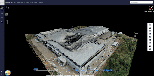
Delta Scan provides independent reality capture and engineering quantification built specifically to support claims. Drone and ground based 3D capture records the site exactly as it stands, producing a measurable digital record of the damage that can be revisited long after the site has been cleared. Confined-space and elevated capture, ground penetrating radar and thermography extend that record into areas that are unsafe or impossible to inspect on foot. Crucially, a registered Professional Engineer then quantifies the loss and the reinstatement scope. Deliverables are prepared and signed under Pr Eng Darryl Epstein (ECSA 202001436), so the claim rests on signed, claim-ready engineering documentation rather than estimates.
Speed matters because evidence is perishable. Delta Scan can mobilise within 24 to 72 hours of a loss, capturing the scene before it is disturbed. This rapid, wide-area response is proven on real South African events: a multi-week aerial response across hundreds of kilometres documenting flood and unrest damage during the 2021 KwaZulu-Natal unrest and the 2022 Durban floods, supporting search and rescue, damage quantification and recovery, and an emergency aerial survey and 3D digital twin of the Jagersfontein tailings dam collapse that allowed the failure to be analysed remotely. For fast-moving events, our disaster response capability puts a defensible record in place while it still exists.
Where a claim later turns into a dispute over cause or liability, the same record underpins forensic engineering investigation, so the evidence gathered on the first day keeps working through to resolution.
For loss adjusters and engineering firms
Delta Scan works directly for property owners as engineer of record, and also on a white-label basis for loss adjusters, insurers and engineering firms who need rapid, accurate capture and quantification behind their own reporting. Either way, the output is independent, measurable and signed.
What to record after a loss event
A practical capture list. The goal is an accurate, dated record before anything is cleared or repaired.
| What to record | Why it matters |
|---|---|
| Overall extent from the air | Establishes the true scale before clean-up begins |
| Structural damage at close range | Separates cosmetic damage from structural loss |
| Waterlines, burn patterns, impact points | Fixes the cause and severity in the evidence |
| Position of debris and displaced plant | Supports causation and the sequence of events |
| Asset and serial identification | Ties damaged plant to the schedule of loss |
| Access and safety hazards | Records the conditions that limit reinstatement |
Get an independent record before the evidence is gone
The single most important step after a major loss is to preserve the scene before it changes. Photograph everything you safely can, keep every damaged item and invoice, and bring in independent capture early. If you are facing a significant flood, fire or storm loss, talk to Delta Scan about insurance loss adjusting support and secure a signed, claim-ready record of the damage while it still exists.