





500m
Core area 03

GIS &
Topographic Mapping

Precision from above, intelligence at ground level. Accurate spatial data for engineering design, mining survey, municipal planning, and environmental monitoring. Delivered by a SAGI-approved team with a 100+ global capture partner network.

Trusted by
Sibanye-Stillwater Eskom Grindrod Debswana TotalEnergies
[01]

The problem
we solve.

Spatial data underpins most engineering and development decisions. If it is wrong, late, or inaccessible, every downstream decision inherits the error. Traditional ground survey is slow, expensive, and limited in coverage. Modern UAV and LiDAR methods are fast and comprehensive but need engineering discipline to interpret correctly.

Delta Scan delivers both: modern capture deployed at the right scale, interpreted by registered professional surveyors, and delivered in the formats and coordinate systems your downstream workflow actually uses.
[02]

Our
methodology.

Survey engagements run in four phases.

  • Phase 1: Scope and flight plan. Deliverables, accuracy requirements, coordinate system, ground control strategy, airspace clearance, and safety plan. Signed survey plan with accuracy statement before mobilisation.
  • Phase 2: Capture. UAV, aerial LiDAR, or fixed-wing for larger sites. RTK and PPK positioning reduces or eliminates ground control points, depending on the accuracy requirement.
  • Phase 3: Processing. Point clouds, orthomosaics, and elevation models processed against control and quality-checked. Raw products uploaded to DeltaCloud for client review before finalisation.
  • Phase 4: Deliverables and sign-off. Final deliverables checked against accuracy targets, signed by a SAGI-approved professional surveyor, and delivered in the client preferred coordinate system and file format.
[03]

What you
receive.

Deliverables are matched to your workflow. Typical outputs include:

  • Orthomosaics at sub-5cm ground sample distance
  • Digital Terrain Models (DTM), Digital Surface Models (DSM), and Digital Elevation Models (DEM)
  • Topographical surveys to professional surveyor standards
  • LiDAR point clouds for vegetation, terrain, and structure
  • 3D point cloud and photogrammetric mesh models
  • Contour plans, cut-and-fill volumetrics, and stockpile reports
  • Bathymetric surveys for water bodies, tailings dams, and coastal work
  • Change detection reports for monitoring sites over time
  • GIS-ready shapefiles, GeoTIFFs, and formats compatible with ArcGIS and QGIS
Selected output

Survey output you can interrogate.

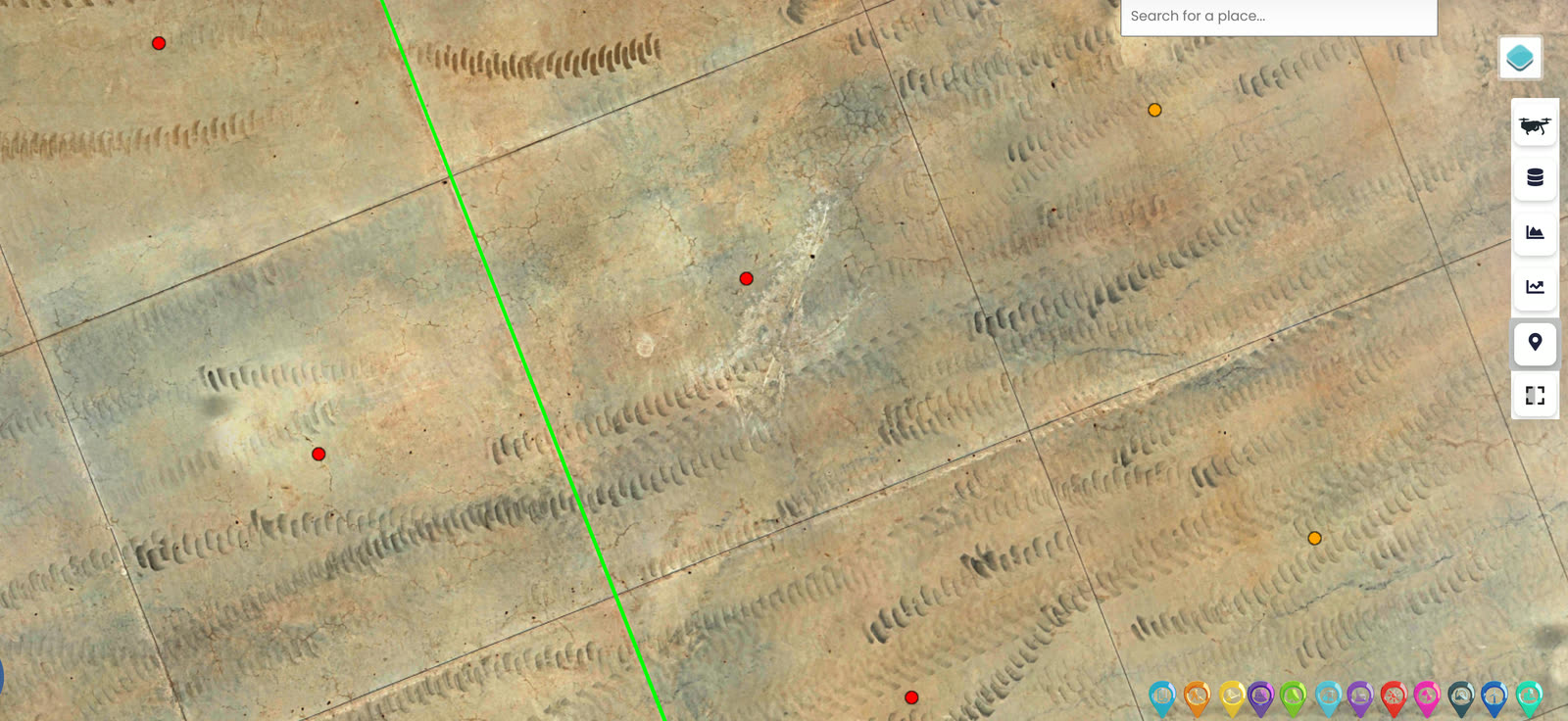
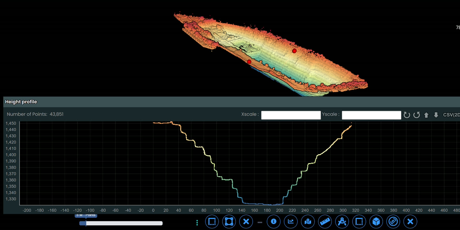
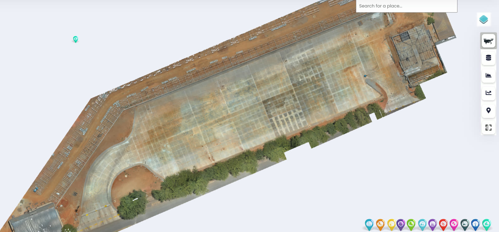
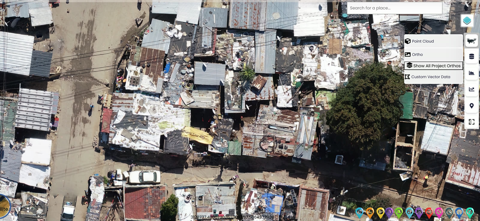
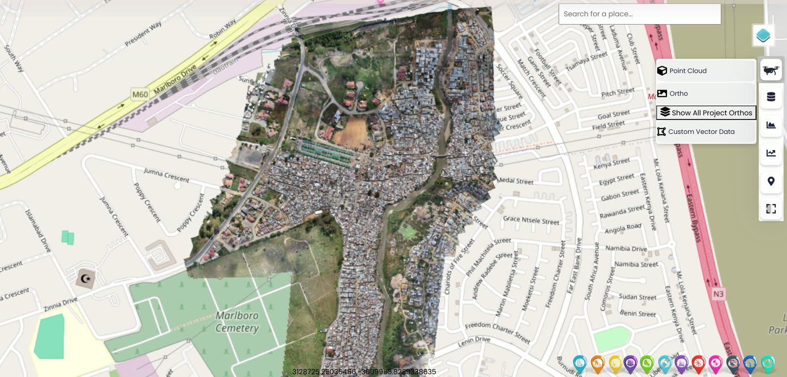
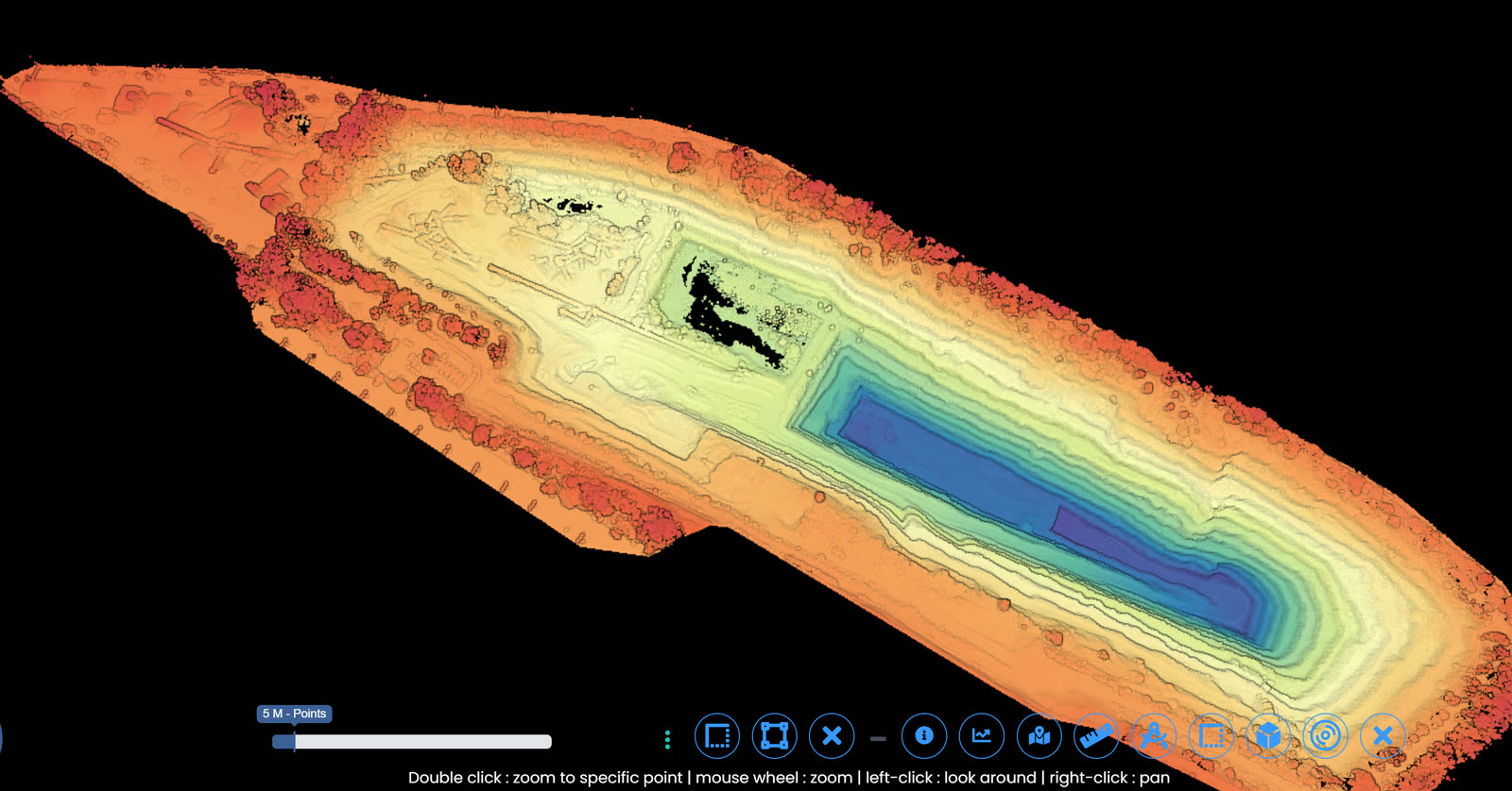
Orthomosaics, terrain models, and volumetric surveys, delivered into a georeferenced platform with point cloud, ortho, and vector layers a surveyor can query and reconcile.

[04]

Equipment
& standards.

Equipment

  • DJI M350 RTK multirotor with L2 LiDAR and P1 photogrammetry payloads
  • Fixed-wing UAV fleet for corridor mapping, mining pits, and large agricultural sites, covering 500+ hectares per flight
  • RTK and PPK positioning systems, eliminating the need for dense ground control point networks
  • Bathymetric sonar attachments for water body surveys
  • 100+ global capture partners for coverage at scale and in geographies requiring local deployment

Standards & compliance

Every survey is signed off by a SAGI-approved, professionally registered surveyor. Deliverables conform to Surveyor-General guidelines for cadastral work where applicable, and to client or industry-specific standards (TMH11 for road corridor surveying, ISO 19152 for land administration data, and others as specified). An accuracy statement accompanies every deliverable.

[05]

Where
it applies.

  • Mining: stockpile volumetrics, tailings dam monitoring, pit development, haul road design
  • Land development: site surveys, contour plans, feasibility-stage terrain analysis
  • Municipal: road and infrastructure asset mapping, flood line modelling, planning submissions
  • Infrastructure: road and rail corridor surveys, powerline route surveys, pipeline routing
  • Environmental: vegetation mapping, coastline change detection, bathymetric monitoring
  • Agriculture: precision agriculture surveys, irrigation design, yield monitoring
[06]

Questions
we hear often.

Straight answers to the questions clients ask most before engaging us.

What accuracy can you achieve?
RTK photogrammetric surveys typically deliver 2 to 5cm absolute accuracy. LiDAR surveys typically deliver 3 to 10cm vertical accuracy depending on vegetation and terrain. Higher accuracy is available with additional ground control, scoped to the project.
How large an area can you cover?
Single-day multirotor coverage reaches up to 400 hectares. Fixed-wing reaches 500+ hectares per flight. Multi-day mobilisations have covered over 20,000 hectares on a single engagement.
Do you need ground control points?
With RTK and PPK, most engagements need no dense GCP network. High-precision applications may still require a limited number of GCPs, scoped in the survey plan.
Can you integrate with our GIS system?
Yes. Deliverables are produced in your preferred coordinate system and in formats compatible with ArcGIS, QGIS, Civil 3D, MicroStation, and other common platforms.
Inside the data

The measurable basis under every model.

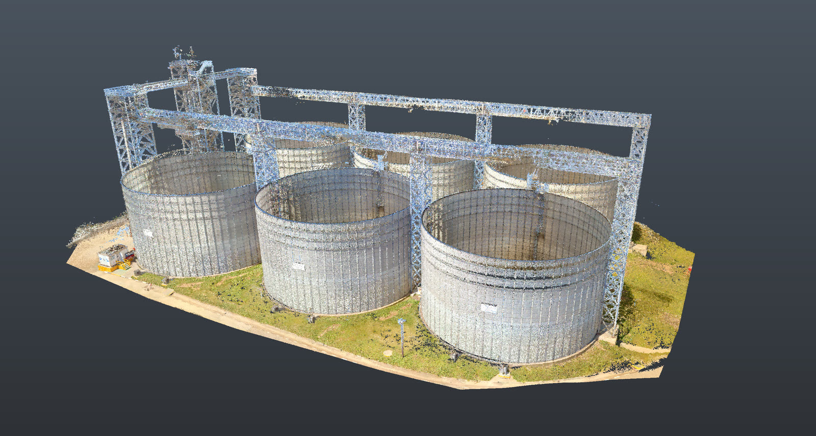
A registered survey-grade point cloud of a silo array and steel gantry, georeferenced to a single common datum Survey-grade registrationMeasurable in the browserSingle common datum
A registered point cloud: georeferenced to a single common datum and ground control, every member measurable to the accuracy class the engineering decision requires.
Accuracy & standards

Built to be signed, not just shared.

Pr EngECSA 202001436

Every engineering deliverable is reviewed and signed by Darryl Epstein, a registered Professional Engineer (Pr Eng, ECSA 202001436).

SAGIsurvey

Geospatial deliverables carry registered land-surveyor sign-off where accuracy must be certified.

Classstated

Every deliverable carries a stated survey accuracy class or BIM level of development (LOD), reported per engagement against check-point analysis.

Standardscited

Findings cross-referenced to the applicable codes (SANS, TMH, EN), with accuracy statements on every report.

Start here

Start a GIS and Topographic Mapping engagement

Send the brief and our engineering team will review your enquiry and reply within one business day. Prefer to talk first? Call or WhatsApp us below.

Response within 1 business day · Pr Eng or SAGI signed

Start a project Call