





Specialised Service

Drone Survey & Aerial Mapping

Survey-grade aerial mapping for mining, civil and infrastructure sites, from a single bridge to a 500-hectare operation. Multirotor and fixed-wing capture, RTK positioning, SAGI-signed deliverables.

Trusted by
Sasol Eskom Impala Platinum Sibanye-Stillwater Afrimat Growthpoint Concor Stefanutti Stocks Zutari Infrastructure South Africa
In short

A drone survey captures topographic and volumetric data from the air using photogrammetry and LiDAR. Delta Scan delivers orthomosaics, terrain models, contours, and volumes with RTK or PPK control and SAGI-approved surveyor sign-off, with the achieved accuracy stated in every report.

A drone survey is only as good as its planning, its ground control, its processing pipeline, and who signs off the deliverable. Delta Scan controls all four, and a SAGI-approved surveyor signs the result. We replace or augment traditional ground-based topographic survey, manned-aircraft aerial photography, and satellite imagery across a wide range of engineering and operational applications.

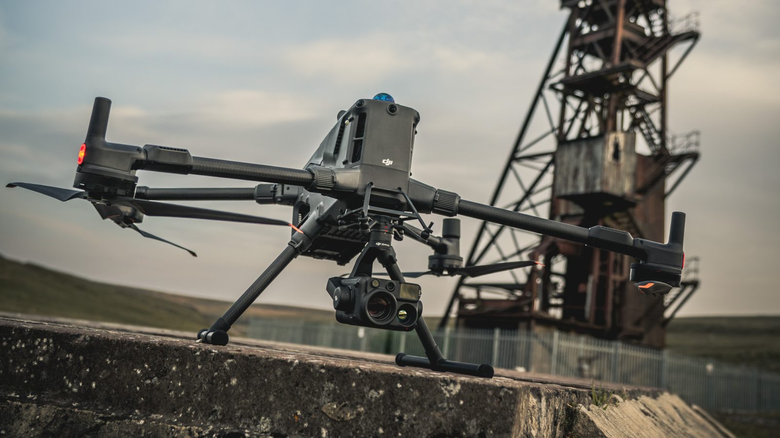
Delta Scan operates DJI Matrice 400 multirotor platforms for medium-scale and high-detail work, and a fixed-wing UAV fleet for large-area surveys exceeding 500 hectares per flight. All capture is positioned with RTK GNSS referenced to permanent base stations or local control. Processing runs through industry-standard photogrammetry and LiDAR pipelines. Every deliverable is reviewed and signed off by a SAGI-approved professional surveyor. The result is survey-grade data suitable for civil engineering design, mining survey, environmental compliance, and asset management.
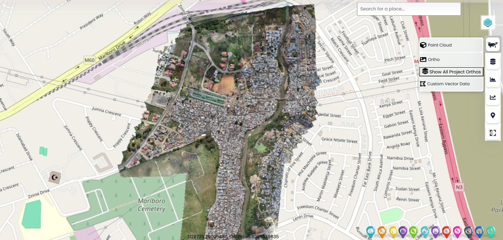
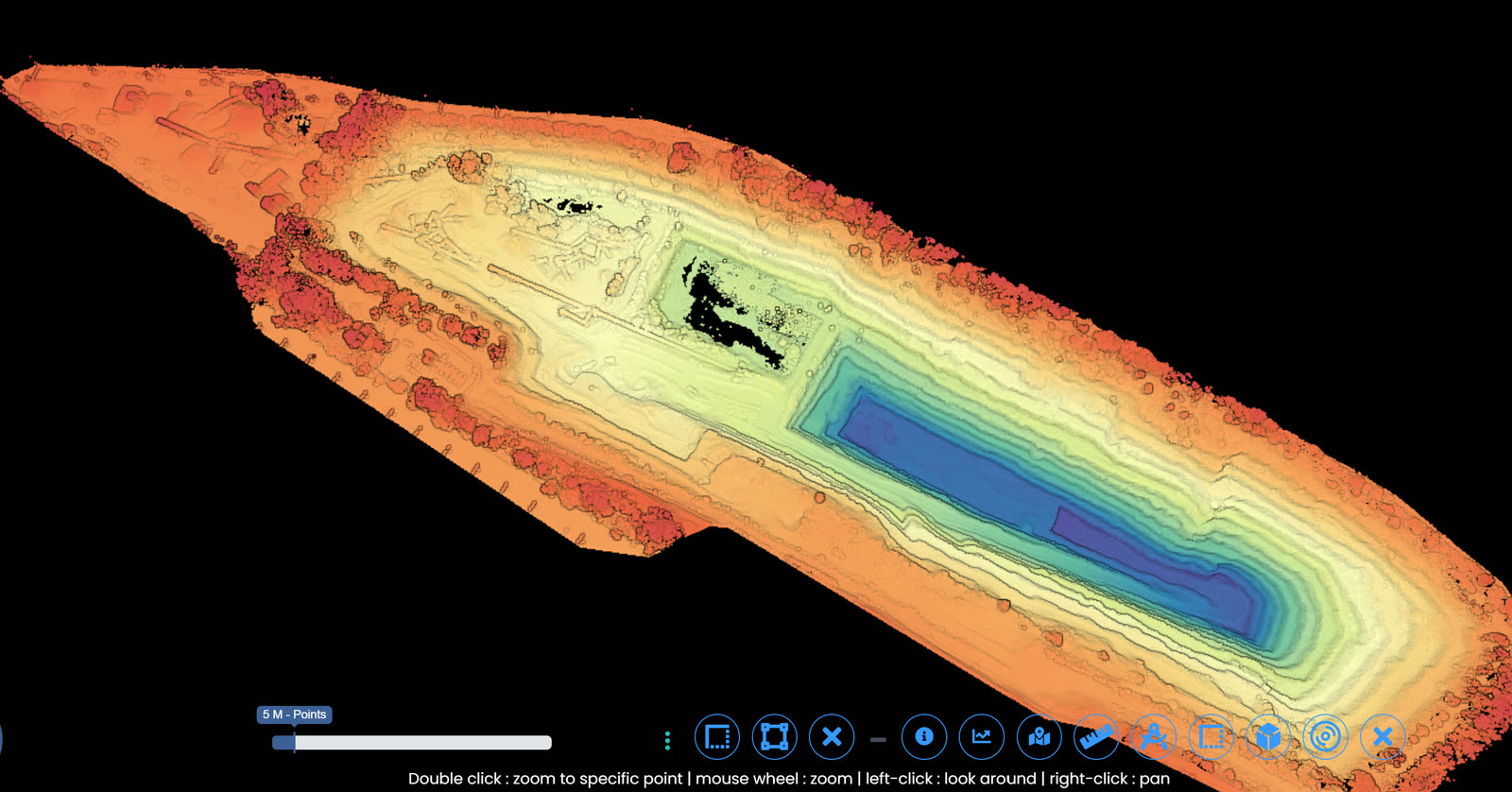
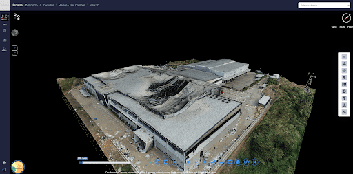
Selected output

From flight to deliverable.

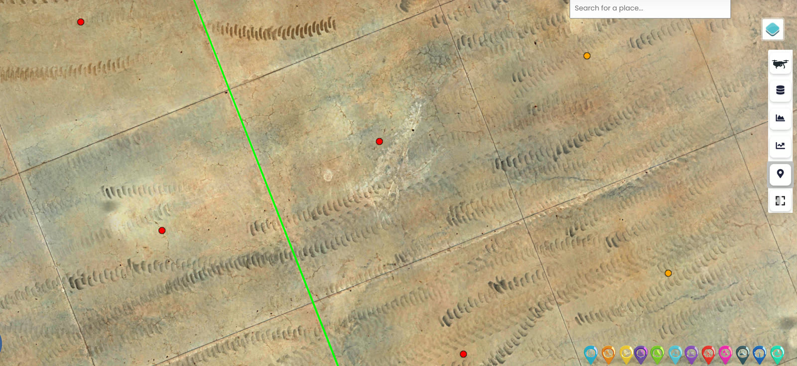
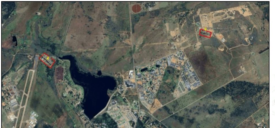
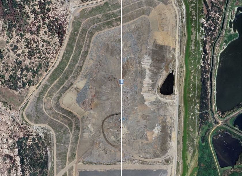
UAV capture reconstructed into orthomosaics, terrain models, and volumetric surveys, georeferenced and surveyor-signed.

When to use it

Typical engagements.

Each scenario below represents a real-world trigger for this service. If your situation matches one of these, get in touch.

Topographic surveys for design

Civil engineering design, building footprint surveys, site grading, road and rail alignment, and infrastructure planning. Sub-centimetre accuracy where control density justifies it.

Mining survey applications

Pit progression surveys, stockpile volumetrics, dump and waste rock surveys, mine plan compliance verification, and end-of-month reconciliation surveys.

Corridor and linear infrastructure

Road, rail, pipeline, and transmission line corridor surveys at scale. Fixed-wing platforms cover hundreds of kilometres in a single mobilisation.

Environmental and compliance

Mining environmental compliance surveys, rehabilitation monitoring, flood line definition, wetland delineation, and erosion tracking.

How it works

Our process.

A repeatable five-stage workflow. The same disciplined sequence runs whether the site is a 500-hectare mining operation or a single 60-metre bridge.

01

Survey planning

Required deliverable accuracy drives the planning. Ground control density, flight altitude, image side-overlap, payload selection, and platform choice are all design decisions made before the first flight.

02

Ground control establishment

Permanent or temporary ground control points are placed and surveyed using RTK GNSS referenced to a Trignet base station or local control network. SAGI-approved surveyor oversees control establishment.

03

Drone capture

Multirotor or fixed-wing flight per the mission plan. RTK positioning provides direct georeferencing. Payload selection matches the target accuracy: photogrammetry for general purposes, LiDAR for forested or vegetated sites where ground returns are critical.

04

Processing

Structure-from-motion photogrammetry produces dense point clouds, digital surface models, digital terrain models, and high-resolution orthomosaics. LiDAR processing includes ground point classification, vegetation filtering, and DTM extraction.

05

SAGI sign-off and delivery

A SAGI-approved professional surveyor reviews and signs off the final deliverable. Outputs include point cloud, DTM, DEM, orthomosaic, contours, volumetrics where requested, and a survey report with accuracy statement.

Request a drone survey quote See our GIS & Topo work
Equipment

What we use.

Calibrated, sector-matched hardware combined with proprietary software. The capture stack is selected for the asset, not the other way around.

DJI Matrice 400

DJI Matrice 400

Primary multirotor platform. RTK GNSS, dual payload bays, all-weather operation. Multi-flight battery management for site coverage in a single mobilisation.

Zenmuse H30T

Zenmuse H30T

Multi-sensor payload with wide, zoom, thermal, and laser rangefinder modules. Single-payload solution for combined topographic and thermal surveys.

Fixed-wing UAV fleet

Long-endurance platforms for very large area coverage. 500+ hectares per flight envelope. Used for mining, environmental, and corridor surveys.

Sectors

Where this fits.

The same engineering discipline applies across Mining survey, Civil engineering and construction, Infrastructure corridors, Environmental and government. The detail changes with the asset class and the operational context.

Mining survey

Pit progression, stockpile volumetrics, dump surveys, rehabilitation monitoring, monthly survey reconciliation

Civil engineering and construction

Design topographic surveys, site grading, as-built verification, progress claim verification

Infrastructure corridors

Road, rail, pipeline, and transmission line surveys, both pre-construction and operational

Environmental and government

Compliance monitoring, flood and erosion surveys, vegetation tracking, post-disaster damage assessment

FAQ

Frequent questions.

Direct answers to the questions clients ask most often before engaging.

What accuracy can I expect from a drone survey?

With proper ground control density and RTK positioning, vertical accuracy of 30 to 50mm and horizontal accuracy of 20 to 30mm is achievable in open terrain. Densely vegetated or built-up sites reduce accuracy. The survey report quotes the actual achieved accuracy from check-point analysis.

How does drone survey compare to ground-based survey?

Ground survey gives sub-centimetre accuracy at discrete points but slow coverage. Drone survey gives dense, full-coverage data at slightly lower point accuracy but vastly higher information density. The two are complementary: ground survey for high-accuracy control points and critical features, drone survey for everything else.

Do I need SACAA approval to commission a drone survey?

No. We hold the necessary SACAA Remote Operator Certificate and pilot licences. The regulatory burden is entirely on us. Where surveys involve restricted airspace (near aerodromes, sensitive sites), we secure the specific clearances as part of the project setup.

Can drones survey through vegetation?

Photogrammetry cannot see through vegetation. LiDAR can, with caveats: dense canopy attenuates the laser return, but ground-point classification on LiDAR data produces a reasonable bare-earth DTM under most South African vegetation conditions.

What deliverable formats do you provide?

Point cloud (LAS/LAZ), digital terrain model (GeoTIFF, ASCII grid), digital surface model, contours (DXF/DWG/shapefile), orthomosaic (GeoTIFF), 3D mesh (OBJ), volumetric calculations, and a signed survey report with accuracy statement. Specific format requirements are confirmed at engagement scoping.

How long does a typical drone survey take?

Field capture for a 100-hectare site is typically half a day. Multirotor sites larger than 500 hectares move to fixed-wing for efficiency. Processing and delivery take three to seven working days for standard topographic deliverables, longer for complex LiDAR or volumetric work.

Accuracy & standards

Built to be signed, not just shared.

Pr EngECSA 202001436

Every engineering deliverable is reviewed and signed by Darryl Epstein, a registered Professional Engineer (Pr Eng, ECSA 202001436).

SAGIsurvey

Geospatial deliverables carry registered land-surveyor sign-off where accuracy must be certified.

Classstated

Every deliverable carries a stated survey accuracy class or BIM level of development (LOD), reported per engagement against check-point analysis.

Standardscited

Findings cross-referenced to the applicable codes (SANS, TMH, EN), with accuracy statements on every report.

Start here

Request a drone survey quote

Send the brief and our engineering team will review your enquiry and reply within one business day. Prefer to talk first? Call or WhatsApp us below.

Response within 1 business day · Pr Eng or SAGI signed

Start a project Call