






Specialised Service

Ground Penetrating Radar Survey

Non-destructive subsurface scanning for utility location, cable tracing and live cable detection, concrete rebar mapping, void detection, and pre-excavation due diligence. Operated by trained surveyors, processed in CAD-ready formats, delivered through DeltaCloud.

Trusted by
Sasol Eskom Impala Platinum Sibanye-Stillwater Afrimat Growthpoint Concor Stefanutti Stocks Zutari Infrastructure South Africa
In short

Ground penetrating radar (GPR) locates buried services, voids, and subsurface features without excavation. Delta Scan uses Proceq GPR to map utilities, rebar, cavities, and sinkhole risk before digging or coring, delivering a georeferenced map of what lies beneath the surface.

Ground penetrating radar is the only practical way to find what is under a surface without breaking that surface. It transmits high-frequency electromagnetic pulses into ground, concrete, asphalt, or masonry and listens for the reflections that come back from interfaces between materials of different dielectric properties. Buried pipes, electrical cables, voids, rebar, tendons, and historical foundations all return distinct signatures.

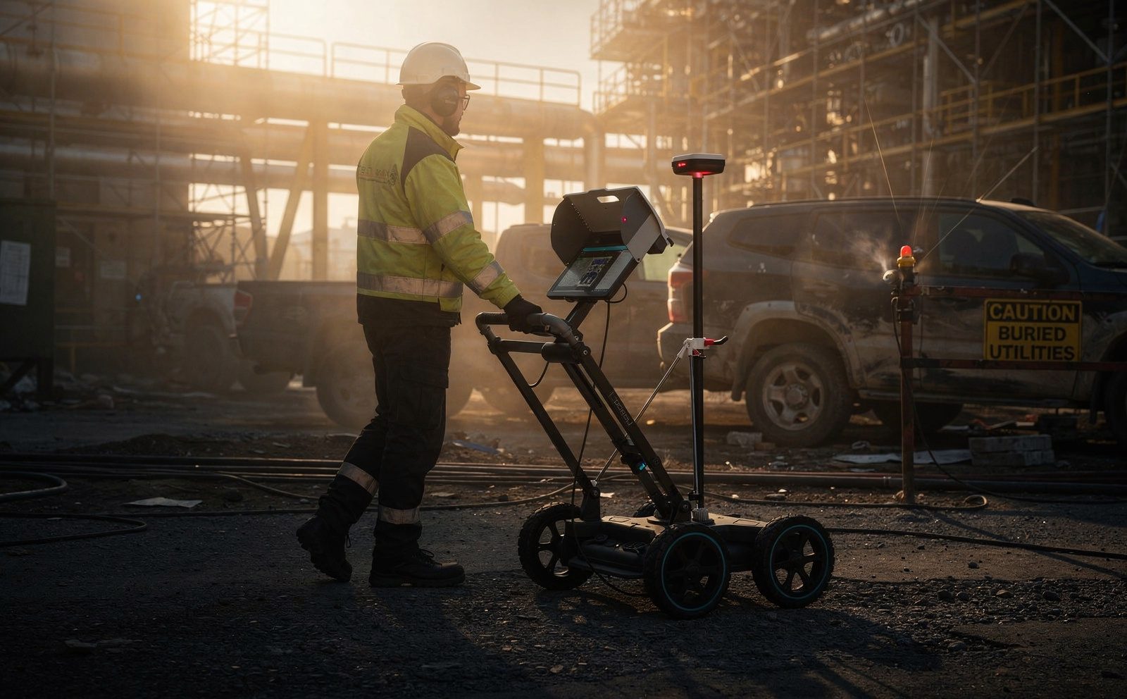
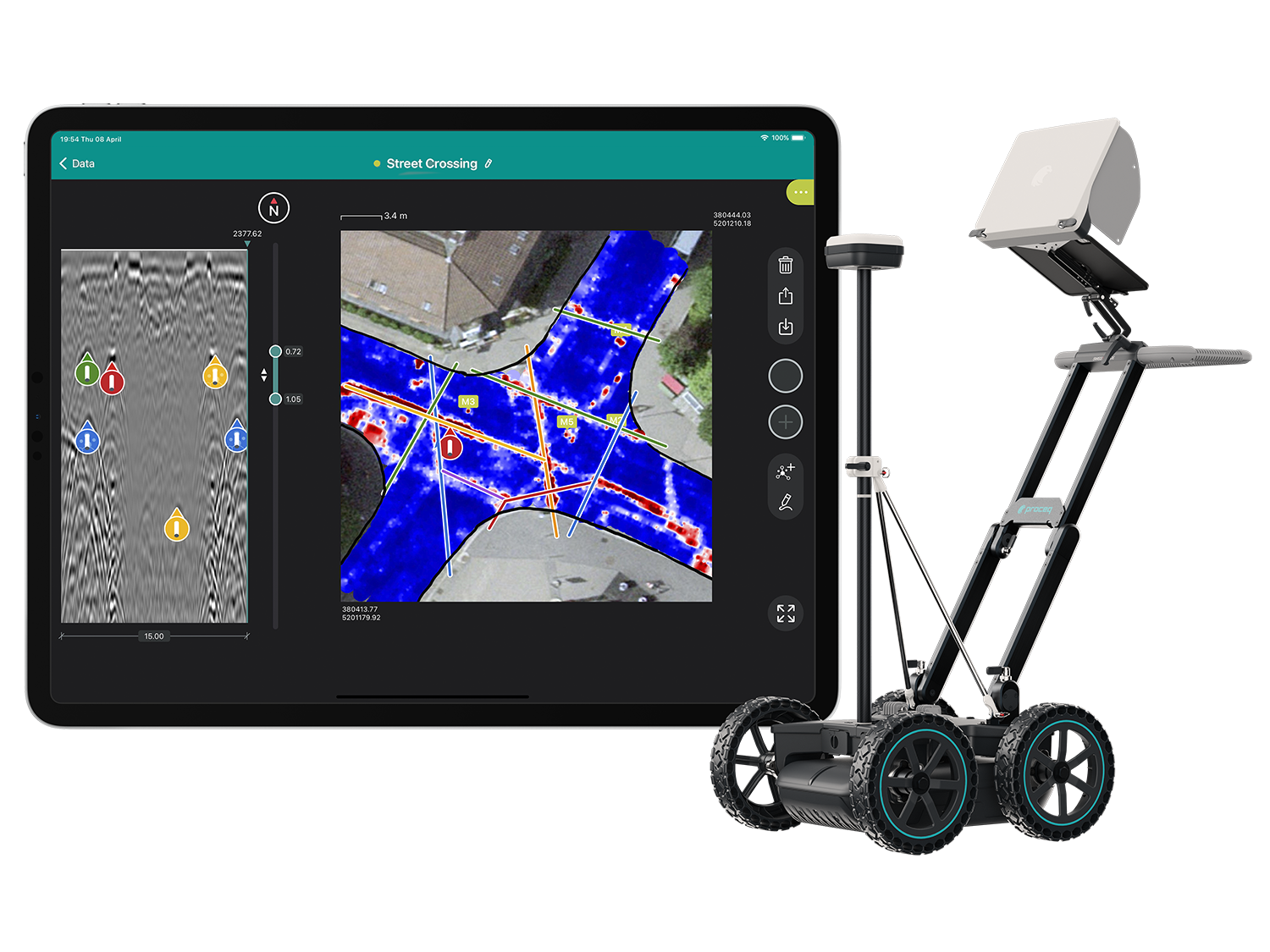
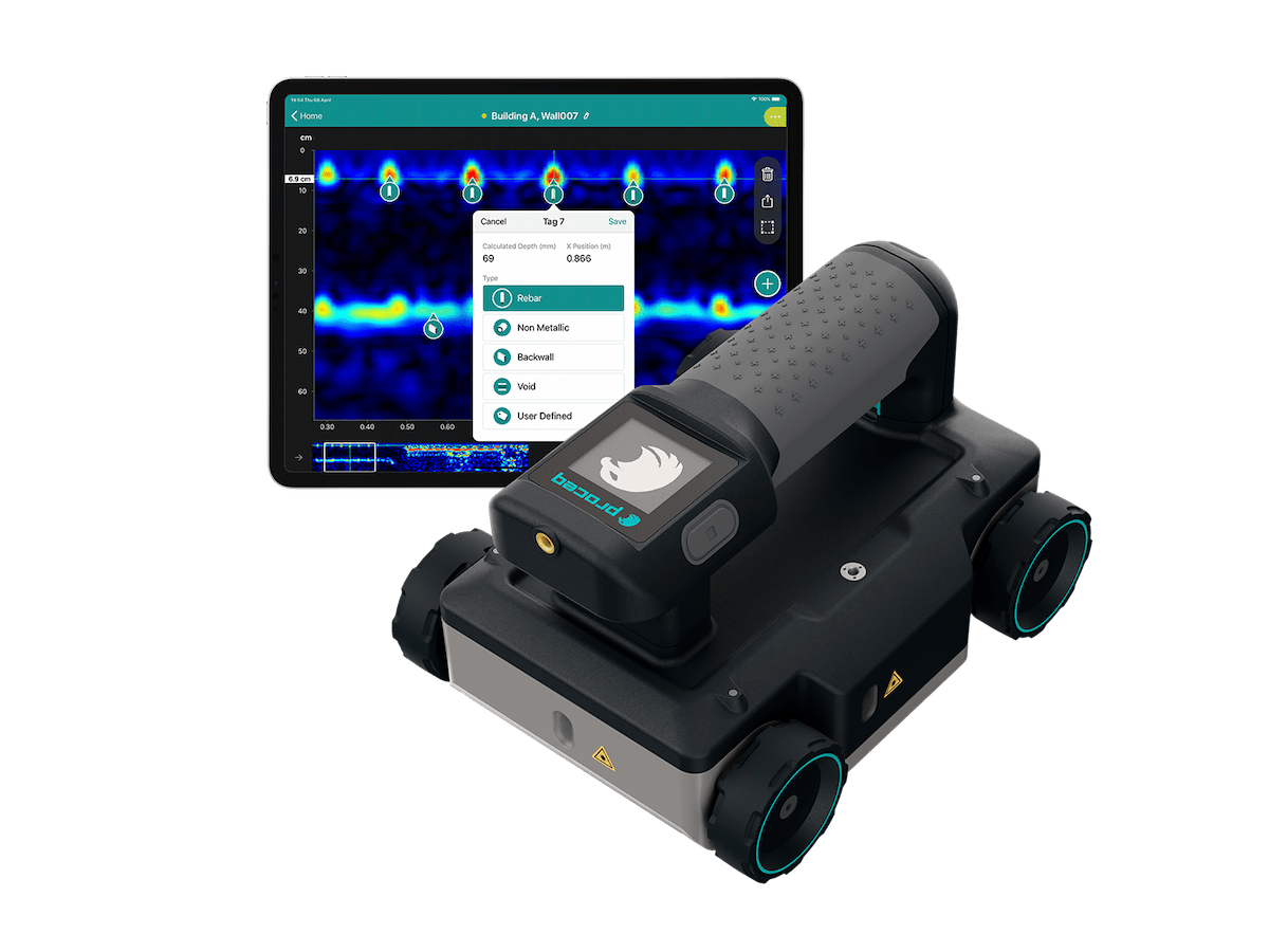
Delta Scan operates two complementary GPR platforms. The Proceq GS8000 wireless wheeled cart is our subsurface utility detection and infrastructure mapping workhorse, used for locating buried services before excavation, surveying utility corridors, and identifying historical infill or buried structures. The Proceq GP8000 portable concrete scanner handles high-resolution non-destructive testing of structural concrete: rebar location, cover depth, slab thickness, post-tensioning duct mapping, and structural anomaly detection. Both feed into our standard deliverable pipeline.
When to use it

Typical engagements.

Each scenario below represents a real-world trigger for this service. If your situation matches one of these, get in touch.

Pre-excavation utility location

Required before any digging or boring near built infrastructure. South African SANS 1936 (Restrictions on the use of dangerous substances) and municipal bylaws require buried-service due diligence to avoid strikes on water, gas, electrical, and fibre lines.

Live cable detection and tracing

Passive detection locates energised power cables before anything is opened, and active tracing follows one identified service along its route to distinguish it from its neighbours. Used together with radar, which also finds the plastic, clay and unenergised runs an electromagnetic sweep cannot see.

Concrete and rebar scanning

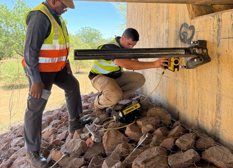
Pre-coring or pre-drilling surveys of structural concrete. Determines rebar layout, cover, slab thickness, void presence, and post-tensioning ducts before any cutting that could compromise structural integrity.

Void and anomaly detection

Sinkhole risk assessment in dolomitic areas (Centurion, parts of Gauteng), under-slab void detection, behind-wall cavities, and historic mine working detection.

Forensic and heritage investigation

Buried foundations of demolished structures, historical archaeological survey, grave location, and structural failure root-cause analysis.

How it works

Our process.

A repeatable five-stage workflow. The same disciplined sequence runs whether the site is a 500-hectare mining operation or a single 60-metre bridge.

01

Site reconnaissance

Pre-survey walk-over to identify access, surface conditions, known services, and survey grid setup. Where existing as-built drawings exist they inform but do not constrain the GPR survey.

02

Survey grid setup

A georeferenced survey grid is established using RTK GNSS or local control. Lines are marked at 0.25m to 1m spacing depending on target resolution. Grid integrity is critical to the quality of the eventual subsurface model.

03

GPR data acquisition

The GS8000 cart or GP8000 handheld scanner is pushed along survey lines collecting continuous radar profile data. Multiple antenna frequencies may be deployed at the same site to balance depth penetration against resolution.

04

Processing and interpretation

Raw radar profiles are processed in proprietary screening software with gain compensation, migration, and target picking. Detected features are classified by depth, signal strength, geometry, and likely material.

05

Deliverable formats

CAD drawings (DXF/DWG) overlaying detected services on site plan, KML/KMZ for Google Earth review, GeoTIFF amplitude maps, and a written interpretation report. Issued through DeltaCloud with full data provenance.

Request a GPR survey quote See our technology stack
Equipment

What we use.

Calibrated, sector-matched hardware combined with proprietary software. The capture stack is selected for the asset, not the other way around.

Proceq GS8000

Proceq GS8000

Wireless single-channel stepped-frequency GPR cart. Subsurface utility and corridor mapping to 8m depth depending on soil conditions.

Proceq GP8000

Proceq GP8000

Portable concrete GPR. Sub-centimetre resolution. Rebar, cover, voids, tendons, and structural anomalies to 600mm depth in concrete.

Sectors

Where this fits.

The same engineering discipline applies across Utilities and municipal, Construction and civil, Mining, Heritage and forensic. The detail changes with the asset class and the operational context.

Utilities and municipal

Water, sewer, stormwater, electrical, gas, and fibre line location ahead of trenching or directional drilling. City of Johannesburg and Gauteng infrastructure works

Construction and civil

Pre-coring concrete inspection, slab thickness verification, post-tensioning duct location, historical foundation discovery on brownfield sites

Mining

Historical mine working detection in shallow surface mining areas, paddock dam structural assessment, conveyor and processing plant foundation review

Heritage and forensic

Buried building footprint location, grave site survey, archaeological feature detection, structural failure investigation

FAQ

Frequent questions.

Direct answers to the questions clients ask most often before engaging.

How deep can ground penetrating radar see?

Soil conditions determine the answer. In dry sandy soils typical of much of the South African interior, the GS8000 reaches 6 to 8 metres. In wet clay or saline soils penetration is reduced to 1 to 3 metres. The GP8000 in concrete reaches 600mm at sub-centimetre resolution.

Can GPR find plastic pipes and fibre optic cables?

Yes. GPR detects any interface between materials of different dielectric properties. Plastic pipes and fibre cables are clearly visible in radar profiles. This is one of the key advantages of GPR over electromagnetic locators which only find metallic services.

Is GPR survey weather-dependent?

Saturated ground after heavy rain reduces penetration depth. Otherwise GPR can be operated in all weather. Frozen ground, light rain, and high humidity have no significant impact.

What is the deliverable format?

CAD layered drawings showing detected services overlaid on the site plan with depth annotations, KML for Google Earth viewing, GeoTIFF amplitude slices, raw radar profile data files for archival, and a written interpretation report signed by the surveyor.

How does GPR compare to electromagnetic locating?

Electromagnetic locators only detect conductive services and are limited to depths of one to two metres in most conditions. GPR detects any subsurface interface regardless of material. A best-practice survey often combines both techniques for full coverage.

Do you provide post-survey support if a service is later struck during excavation?

Yes. Our reports include a confidence rating against each detected service. If an unmarked service is encountered during excavation we provide a re-survey at no charge to investigate the cause. Detection limitations are documented honestly upfront, not in the small print.

Related services

If this fits, these often do too.

Engineering programmes rarely run on a single service. These adjacent capabilities most often pair with the work above.

Accuracy & standards

Built to be signed, not just shared.

Pr EngECSA 202001436

Every engineering deliverable is reviewed and signed by Darryl Epstein, a registered Professional Engineer (Pr Eng, ECSA 202001436).

SAGIsurvey

Geospatial deliverables carry registered land-surveyor sign-off where accuracy must be certified.

Classstated

Every deliverable carries a stated survey accuracy class or BIM level of development (LOD), reported per engagement against check-point analysis.

Standardscited

Findings cross-referenced to the applicable codes (SANS, TMH, EN), with accuracy statements on every report.

Start here

Request a GPR survey quote

Send the brief and our engineering team will review your enquiry and reply within one business day. Prefer to talk first? Call or WhatsApp us below.

Response within 1 business day · Pr Eng or SAGI signed

Start a project Call