



Specialised Service

Digital Twin Services

Engineering-grade digital twins of industrial, mining, and infrastructure assets. Multi-sensor reality capture, parametric reconstruction, audit-trail versioning, and browser-based stakeholder access through DeltaCloud.

Trusted by
Sasol Eskom Impala Platinum Sibanye-Stillwater Afrimat Growthpoint Concor Stefanutti Stocks Zutari Infrastructure South Africa
In short

A digital twin is an accurate, queryable 3D replica of a physical asset, kept current as the asset changes. Delta Scan builds engineering-grade twins from multi-sensor capture, delivered in DeltaCloud with version control so teams can measure, inspect, and plan against real geometry remotely.

A digital twin in the engineering sense is not a 3D model. It is a continuously updated, dimensionally accurate, semantically structured digital representation of a physical asset, paired with the workflow that keeps it current as the asset changes. The difference matters commercially: a model is a deliverable, a twin is an operational asset that earns value through the engagements it informs over its life.

Delta Scan builds engineering-grade digital twins for clients in mining, energy, infrastructure, and industrial operations. The capture stack is platform-agnostic (LiDAR, photogrammetry, GPR for buried services, thermal for energy mapping). The processing pipeline produces parametric, semantically tagged geometry, not just point clouds. The hosting environment is DeltaCloud, where audit-grade access logs, role-based permissions, and integration APIs let asset owners use the twin as the canonical engineering record of their facility.
Selected output

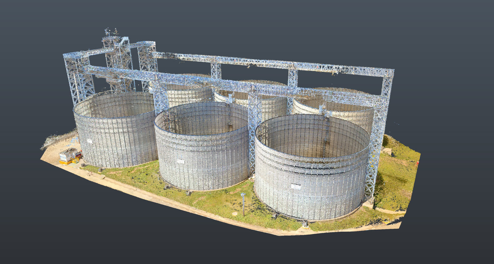
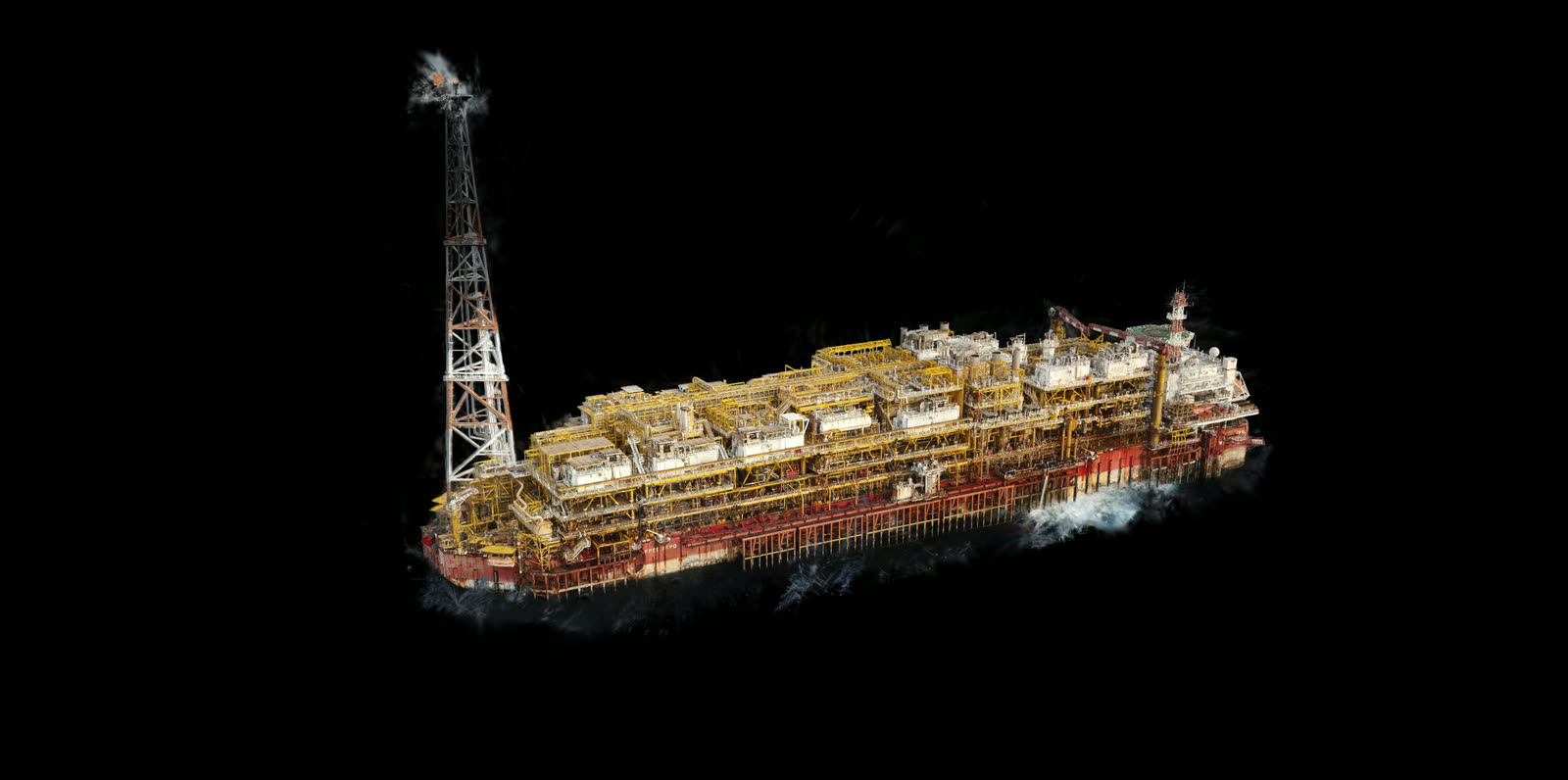
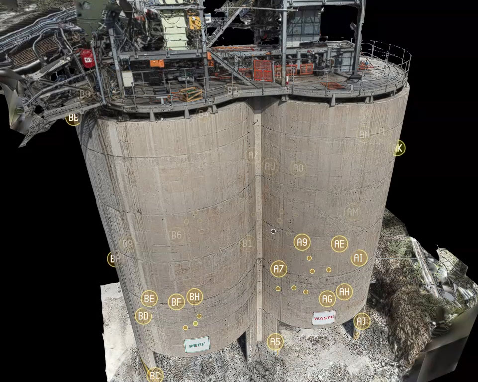
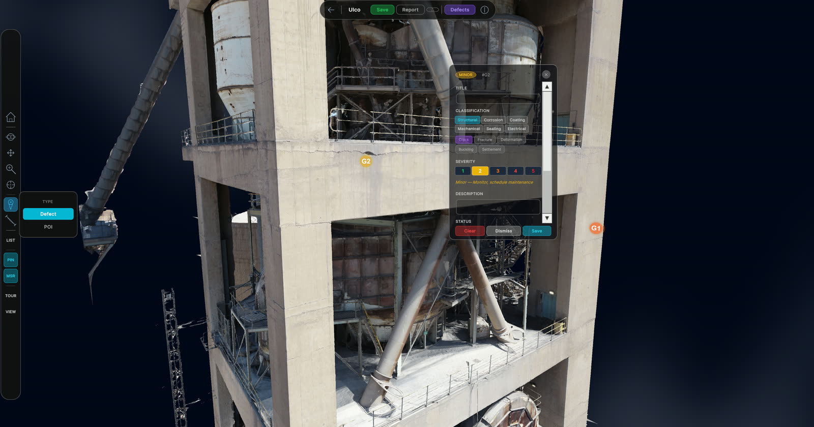
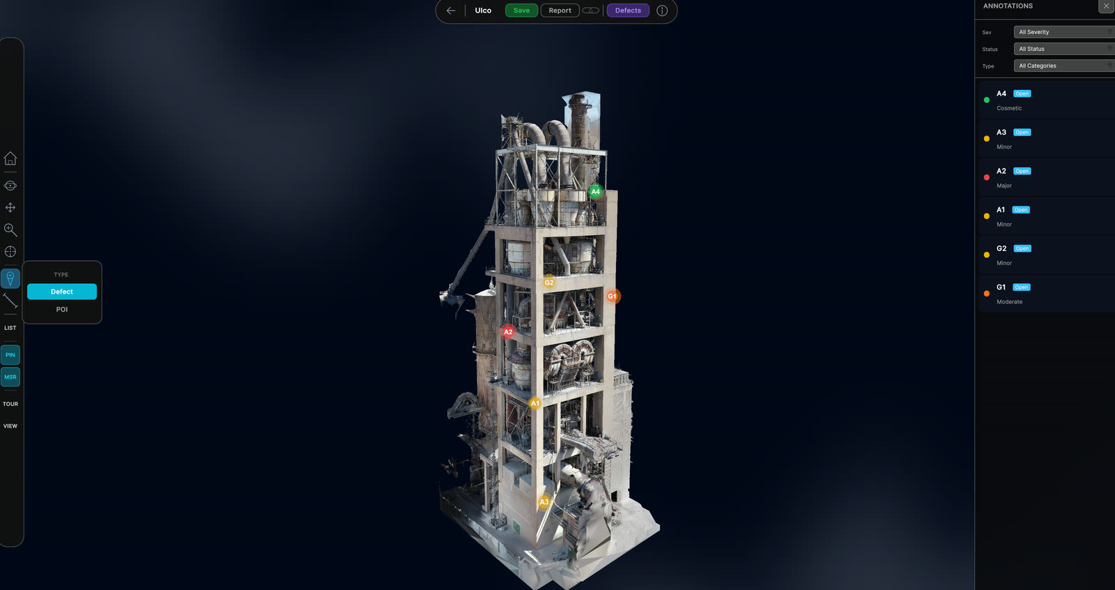
Twins you can walk through.

Navigable 3D digital twins built from survey-grade capture, hosted for remote inspection, defect tagging, and change detection.

When to use it

Typical engagements.

Each scenario below represents a real-world trigger for this service. If your situation matches one of these, get in touch.

Brownfield asset documentation

For operating assets with no surviving as-built documentation, a digital twin establishes the engineering record before any modification, expansion, or due-diligence event.

Capital project handover

New construction handed over with a complete, audit-grade digital twin shortens the operator commissioning curve and provides the baseline against which future condition assessments are measured.

Operational decision support

A live digital twin lets operations, engineering, and HSE teams interrogate the asset remotely. Maintenance planning, clash analysis on shutdown work, contractor briefing, and incident review all benefit.

Acquisition due diligence

For corporate acquirers, an independent digital twin survey of the target asset provides quantitative evidence of condition, capacity, and integrity that paper-based due diligence cannot match.

How it works

Our process.

A repeatable five-stage workflow. The same disciplined sequence runs whether the site is a 500-hectare mining operation or a single 60-metre bridge.

01

Twin scope definition

A pre-engagement workshop scopes the twin: which physical asset, what level of detail (LOD), which systems and components, what update cadence, and which stakeholder roles will access the twin and for what purpose.

02

Multi-sensor capture campaign

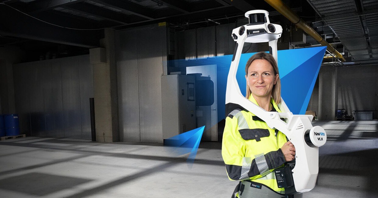
Coordinated capture using the appropriate combination of UAV photogrammetry, terrestrial LiDAR, mobile mapping LiDAR (NavVis VLX 3), GPR for buried services, and thermal imaging. Capture is georeferenced to the operator's site control network.

03

Parametric reconstruction

Raw capture data is reconstructed into parametric, semantically tagged geometry. Mechanical equipment is tagged at the tag-number level. Structural components carry material and section properties. Services are split into systems for selective viewing.

04

DeltaCloud commissioning

The twin is commissioned in a project-specific DeltaCloud workspace with role-based access for the operator's engineering, HSE, maintenance, and contractor teams. Audit logging is enabled from day one.

05

Lifecycle update workflow

A formal update workflow keeps the twin current as the asset changes. Modifications are captured at completion, processed within an agreed turnaround, and versioned into the canonical twin with full audit history.

Request a digital twin scoping call See DeltaCloud platform
Equipment

What we use.

Calibrated, sector-matched hardware combined with proprietary software. The capture stack is selected for the asset, not the other way around.

DeltaCloud platform

DeltaCloud platform

The delivery and lifecycle spine for every Delta Scan twin. Versioned storage, role-based access, browser-based viewers, REST and OData APIs, audit-trail logging.

NavVis VLX 3

NavVis VLX 3

Wearable mobile mapping LiDAR. Walking-pace indoor and outdoor capture without operational interruption. Primary platform for facility twin capture.

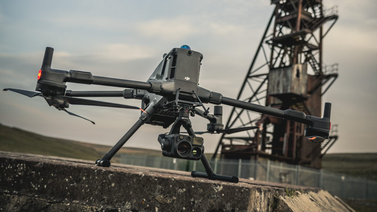
DJI Matrice 400 + Zenmuse H30T

DJI Matrice 400 + Zenmuse H30T

Aerial photogrammetry, RTK positioning, thermal mapping. Exterior, roof, and high-altitude capture for full-asset twins.

Sectors

Where this fits.

The same engineering discipline applies across Mining, Energy, Industrial and manufacturing, Infrastructure. The detail changes with the asset class and the operational context.

Mining

Headgear, mill houses, processing plants, conveyor corridors, surface infrastructure, TSF facilities. Twins inform shutdown planning, expansion design, and decommissioning

Energy

Power station mechanical, electrical, and structural systems. Refinery process plant. Renewables installations. Decommissioning and life-extension planning

Industrial and manufacturing

Manufacturing facility brownfield documentation, process plant twins for shutdown planning, contractor briefing environments

Infrastructure

Bridge, tunnel, and water infrastructure twins for asset management, condition trend tracking, and rehabilitation design

FAQ

Frequent questions.

Direct answers to the questions clients ask most often before engaging.

What is the difference between a 3D model and a digital twin?

A 3D model is geometric. A digital twin is geometric plus semantic plus operational: tagged components, lifecycle update workflow, role-based access, and integration with the operator's asset management. Most "digital twins" in the market are 3D models with optimistic naming.

Do I need specialist software to view the twin?

No. DeltaCloud provides browser-based viewers for the twin geometry, supporting point cloud, mesh, BIM, and orthomosaic views. Specialist software (Revit, Navisworks, AutoCAD) is supported for stakeholders who need editing access.

How current does the twin stay?

As current as the update workflow you agree. For a power station where modifications happen frequently, monthly synchronisation is typical. For a stable industrial asset, annual re-capture with as-needed delta updates is sufficient.

What level of detail (LOD) can you deliver?

From LOD 200 (massing and zone-level) through LOD 400 (fabrication-grade detail). Most operational twins land at LOD 300, which is detailed enough for clash analysis and maintenance planning but not unnecessarily heavy for the use cases.

Can the twin integrate with my asset management system?

Yes. DeltaCloud exposes REST and OData APIs that integrate with most enterprise asset management systems (SAP PM, Maximo, eMaint), GIS systems, and operations dashboards.

What about security and access control?

DeltaCloud enforces role-based access at project, folder, and component level. Every access is logged. Data residency can be constrained to specific jurisdictions for clients with sovereignty requirements. POPIA and GDPR compliant.

How does this differ from "scanning to BIM"?

Scan to BIM is a deliverable: capture, process, hand over the model, engagement ends. A digital twin is a service: the same starting capture, but committed to a multi-year lifecycle relationship including updates, access management, and operational support.

Related services

If this fits, these often do too.

Engineering programmes rarely run on a single service. These adjacent capabilities most often pair with the work above.

Accuracy & standards

Built to be signed, not just shared.

Pr EngECSA 202001436

Every engineering deliverable is reviewed and signed by Darryl Epstein, a registered Professional Engineer (Pr Eng, ECSA 202001436).

SAGIsurvey

Geospatial deliverables carry registered land-surveyor sign-off where accuracy must be certified.

Classstated

Every deliverable carries a stated survey accuracy class or BIM level of development (LOD), reported per engagement against check-point analysis.

Standardscited

Findings cross-referenced to the applicable codes (SANS, TMH, EN), with accuracy statements on every report.

Start here

Request a digital twin scoping call

Send the brief and our engineering team will review your enquiry and reply within one business day. Prefer to talk first? Call or WhatsApp us below.

Response within 1 business day · Pr Eng or SAGI signed

Start a project Call