ROV Inspection
Below the Waterline
Engineering inspection of submerged, flooded and below-waterline assets using a remotely operated vehicle, for the places a diver cannot safely reach and dewatering is impractical. Visual and measured condition data, reviewed and signed by a registered professional engineer.
An ROV underwater inspection gives you eyes, measurement and a signed engineering assessment below the waterline, in conditions where putting a diver in the water is hazardous and draining the structure is slow, costly or simply not an option. A remotely operated vehicle is flown through the flooded or submerged space on a tether, capturing high-definition video and positional data across the full asset rather than a few sampled points. The core value is not the vehicle. It is that an engineer of record gets defensible condition evidence on a submerged dam wall, a flooded shaft, a quay wall or a platform substructure without the safety exposure, programme delay and expense of diving or dewatering, and that the findings are interpreted and signed under Pr Eng oversight.
Where it is used
Offshore and nearshore oil and gas
Inspection below the waterline on fixed platforms, jackets and subsea infrastructure: jacket legs, braces and nodes, riser and caisson condition, conductor guides, J-tubes, anodes and the state of the cathodic protection system, marine growth and biofouling extent, scour and seabed gap at the base of the structure, pipeline and flowline spans and free spans, mooring and umbilical condition, and the seabed footprint around the asset.
Dams and water infrastructure
Submerged and below-waterline condition of the parts that are hardest to see and most expensive to dewater: the upstream face of the dam wall, plunge pool and stilling basin scour, the apron and toe, intake towers and trash racks, low-level outlets, penstocks, draft tubes and tailrace, gate and stoplog seats and guides, sediment and debris accumulation against the wall, and reservoir siltation reducing live storage capacity.
Flooded mining workings
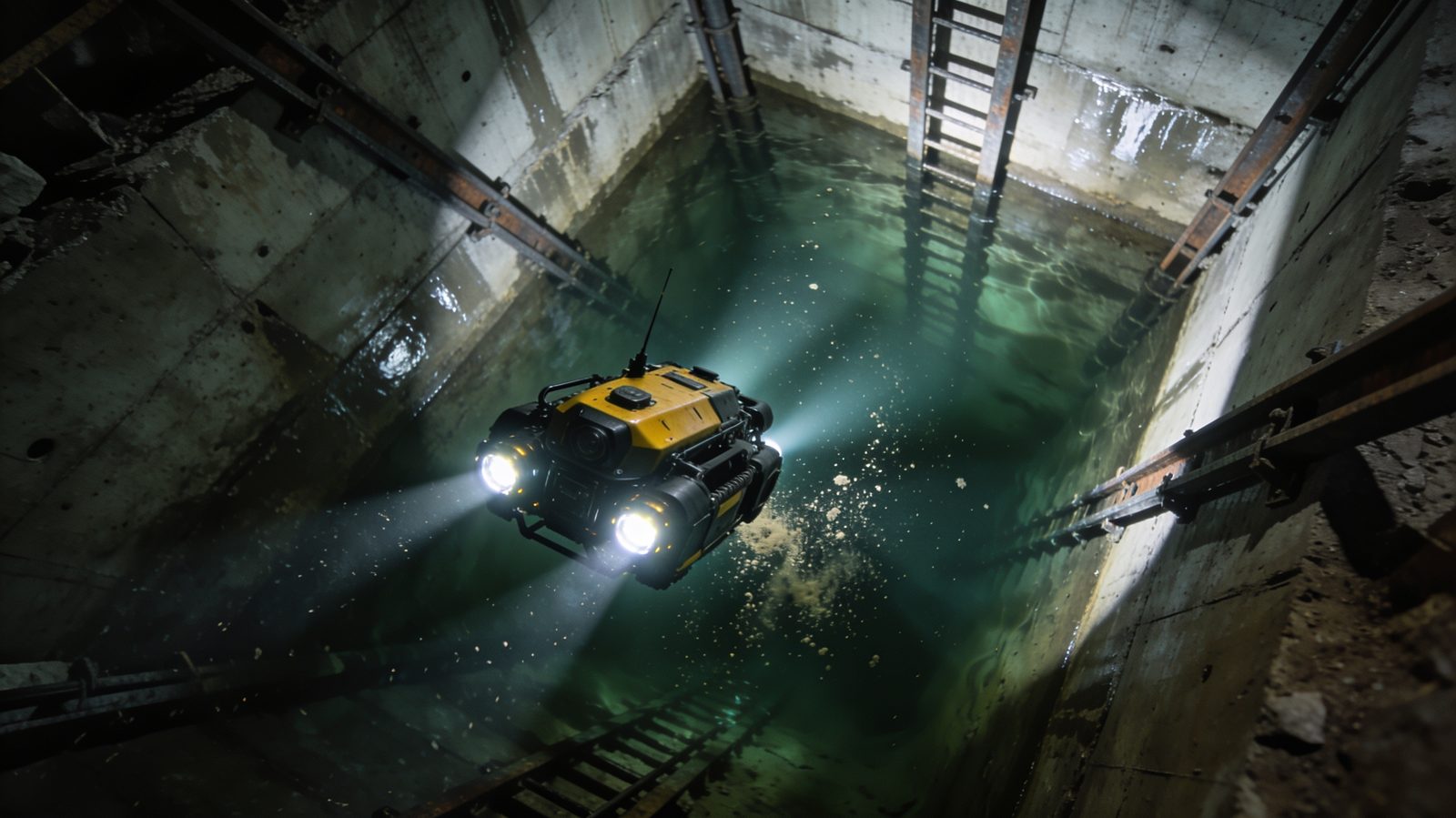
Inspection inside flooded vertical and inclined shafts, tunnels, declines, ore passes, sumps and pump chambers where dewatering is impractical, dangerous or would take the asset out of service. Captures shaft and tunnel lining condition, steelwork, guides and shaft furniture, blockage, hang-up and debris geometry, sediment and silt build-up in sumps, and the as-found condition of flooded legacy and decommissioned workings before any rehabilitation or re-watering decision.
Ports, harbours and marine
Below-water inspection of quay and berth structures: quay walls, sheet and combi-pile walls, fender and bollard fixings below water, piles and pile sleeves, scour and undermining at the toe of the wall and around piles, rock armour and scour protection, lock and dock gates, intake and outfall structures, and seabed and berth-pocket debris ahead of dredging or berthing assessments.
What an ROV inspection answers
- What is the structural condition of the submerged element: cracking, spalling, exposed or corroded reinforcement, joint movement, displacement, loss of section, and damaged or missing components?
- Is there scour, undermining or a developing seabed or foundation gap at the base of the wall, the toe, or around piles and the structure footprint?
- What is the extent and rate of corrosion below the waterline, and is the cathodic protection system or coating still doing its job?
- Where are the blockages, debris, hang-ups and obstructions, how large are they, and how are they distributed through the flooded space?
- How much siltation or sediment has accumulated, and what does that mean for live storage capacity, sump capacity or dredging volumes?
- Where, precisely, are the defects, mapped to a position on the asset so the engineer of record can locate, prioritise and re-inspect them?
Why an ROV, not divers or dewatering
Below the waterline you have three ways to get an engineer the evidence they need, and they are rarely equal. Sending divers puts people into a hazardous, often very low visibility, confined and pressurised environment, with the full overhead of dive safety, supervision and standby, and a limited bottom time that caps how much of the asset gets seen. Dewatering a shaft, tunnel, penstock or impoundment removes the water but at a heavy price in programme, pumping cost, lost production or supply, and the structural and environmental risk of changing the load and pore-pressure state of an asset that has stood flooded for years. An ROV avoids both. No one enters the water, so the highest-consequence safety exposure is removed while the procedural discipline stays in place. The vehicle can reach depths, distances and confined geometry beyond safe diver limits and works in turbid and low-visibility water where a diver would be inspecting by feel, with the achievable reach confirmed for each asset. On many assets it is also more cost-effective than a dive spread or a dewatering campaign once downtime and lost service are properly costed, and it is repeatable: the same flight plan can be run again next cycle to track change between inspections rather than relying on a one-off subjective account.
- Safety: no personnel in the water, removing the highest-consequence exposure while permit, isolation and standby discipline remain in place.
- Access and depth: can reach depths, tether distances and confined geometry beyond safe diver limits, inside shafts, tunnels, penstocks and intakes, with achievable reach confirmed per asset.
- Works in turbid and low-visibility water that would force a diver to inspect by touch.
- No dewatering: avoids the cost, programme delay, lost production and structural or pore-pressure risk of draining a shaft, tunnel or impoundment.
- Cost: often more cost-effective than a dive spread or a dewatering campaign once downtime and lost service are costed in.
- Coverage and repeatability: full-asset capture rather than sampled points, with a repeatable flight plan for like-for-like change detection between inspection cycles.
The deliverable: a signed engineering assessment, not just footage
The deliverable is a structured underwater inspection report reviewed and signed by a registered professional engineer (Pr Eng, ECSA), not raw footage handed over without interpretation. It combines the inspection video with a defect register, each finding located on the asset, classified by type and severity, and tied to a clear engineering observation, alongside recommended interventions and any items flagged for priority attention. The signature is the moat: under Pr Eng oversight, with professional indemnity cover behind it, the findings carry the engineering accountability that an engineer of record, asset owner or regulator can rely on and that a video file alone cannot provide. Where Delta Scan also captures the above-water structure with LiDAR and reality-capture survey, the below-water findings are registered into the same coordinate framework, so the submerged condition and the visible structure read as one continuous, measurable model of the whole asset above and below the waterline. For engineering firms, the same inspection can be delivered on a white-label basis so the findings sit cleanly under your own engineer of record.
Method and safety
Each inspection is planned around the specific asset: access points, water depth, flow and current, confinement, contamination and the condition data the engineer of record actually needs. A remotely operated vehicle is flown through the submerged or flooded space on a tether, capturing high-definition video and positional data across the full structure, operator-guided to areas of specific concern. Confined and flooded spaces remain confined spaces even with no one in the water, so the work runs under the same permit-to-work, atmospheric testing, isolation and standby discipline as any confined-space entry, with a job-specific risk assessment and emergency procedures agreed with the asset owner before deployment. Scope, access and the conditions that drive feasibility are confirmed per project.
What we need to scope your inspection
- The asset and sector: offshore platform or subsea, dam or water structure, flooded mine working, or port and marine structure.
- What you need inspected and the engineering question behind it (structural condition, scour, corrosion, blockage or debris, siltation, defect mapping).
- Water depth, and for flooded shafts, tunnels or sumps the approximate flooded depth and length.
- Water conditions: fresh or salt, expected visibility and turbidity, flow or current, and any known contamination or hazards.
- Access points and how the vehicle can be deployed (collar, manhole, intake, bank, quay, vessel or platform deck).
- Whether the space is or may be a confined space, and the site permit, isolation and standby requirements that apply.
- Whether above-water LiDAR or reality-capture survey is also required, so below-water and above-water data integrate into one model.
- Site location and access, target dates, and whether this is a one-off inspection or a recurring monitoring cycle.
- Whether the deliverable is for your own engineer of record or to be delivered white-label under your firm.
Related Delta Scan services
Get a submerged asset assessed without putting a diver in the water
Tell us the structure, the depth and the engineering question, and we will scope an ROV underwater inspection and a Pr Eng signed deliverable. Feasibility, access and conditions confirmed per project.