





Specialised Service

Disaster Response & Rapid Loss Documentation

When a flood, fire, explosion, or structural collapse hits, the first 72 hours decide what evidence survives. Delta Scan mobilises drone and ground reality capture fast, records the site before conditions change, and delivers signed engineering documentation that owners, insurers, and authorities can act on.

Trusted by
Sibanye-Stillwater Eskom Grindrod Debswana TotalEnergies
In short

Disaster response documentation preserves the evidence a claim or investigation will need before the site changes. Delta Scan mobilises drone and 3D capture within 24 to 72 hours of a flood, fire, explosion, or collapse, and delivers a Pr Eng signed record of the site as it stood.

Disaster sites deteriorate from the moment the event ends. Floodwater recedes, debris is cleared for safety, weather works on exposed structures, and recovery operations alter the very evidence that reserve setting, claims, and investigations depend on. Whoever needs that record later, whether an asset owner, an insurer, a loss adjuster, or a public authority, needs it captured early, completely, and to a standard that will hold up months later.

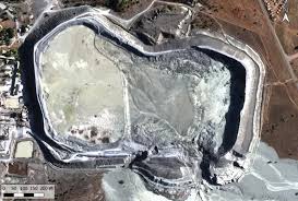
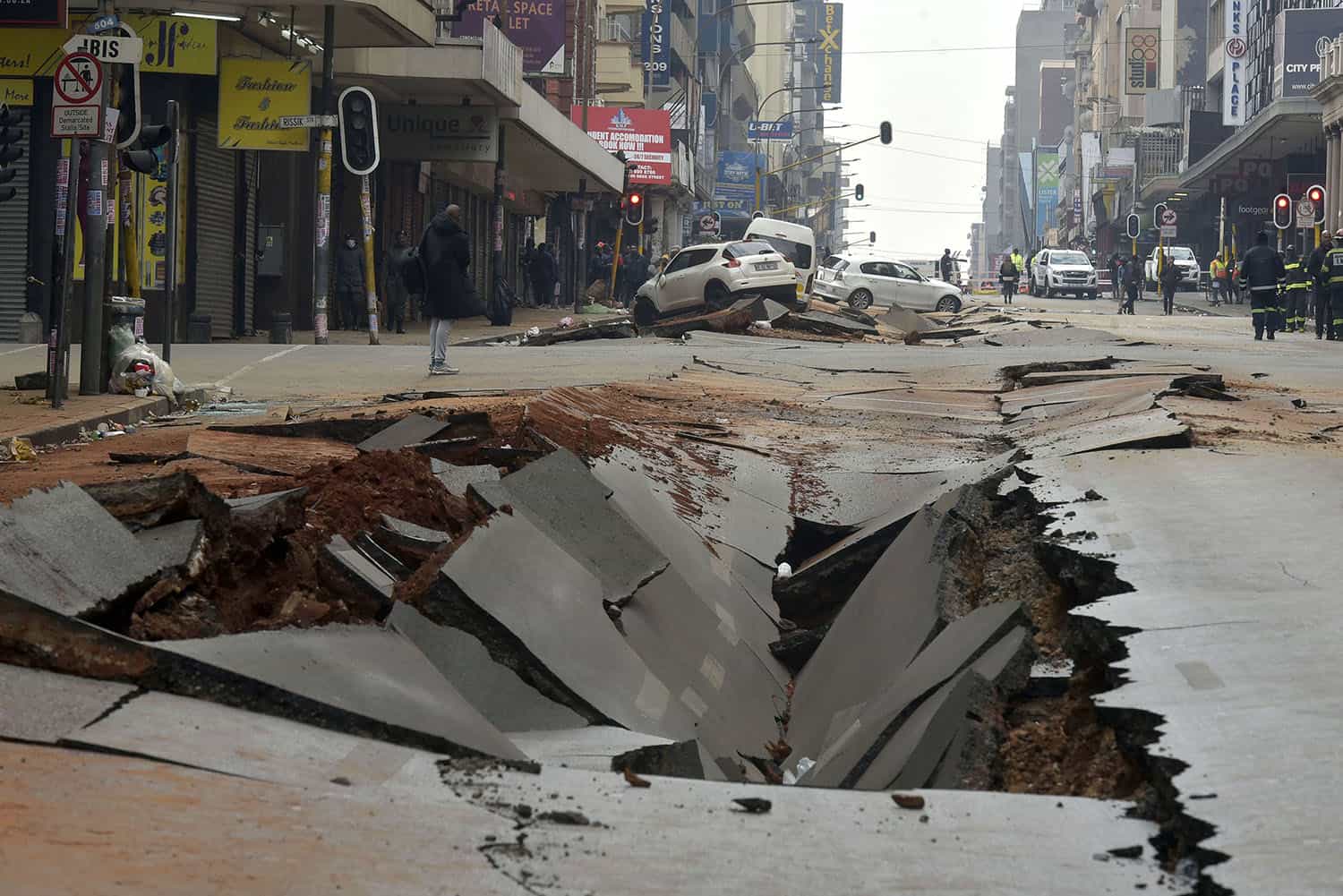
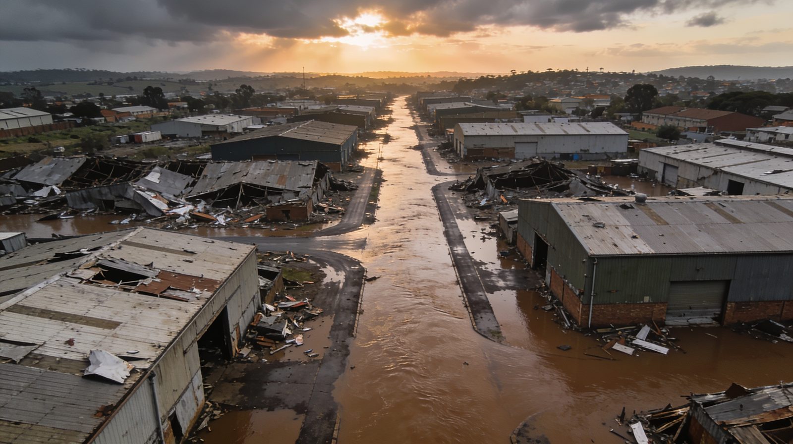
Delta Scan runs a dedicated disaster response lane built on real deployments: multi-site drone survey across thousands of damaged premises after the 2021 KZN civil unrest, wide-area capture of the 2022 Durban floods, documentation of the Jagersfontein tailings dam failure, and the Johannesburg CBD road explosion. The pattern is the same each time: rapid mobilisation, wide-area and close-quarters capture, and a measurable 3D record of the site as it stood, reviewed and signed under registered Pr Eng oversight.
When to use it

Typical engagements.

Each scenario below represents a real-world trigger for this service. If your situation matches one of these, get in touch.

Flood and storm events

Wide-area drone capture of flood and storm damage across industrial, commercial, and municipal areas. Orthomosaics and 3D terrain document the extent of damage before water recedes and clean-up begins.

Fire and explosion

Post-incident capture of fire and explosion damage, including thermal mapping and confined-space capture of structurally compromised interiors that people cannot safely enter.

Collapse and containment failures

Structural collapses, dam and tailings facility failures, and sinkhole events. The site is recorded in measurable 3D before recovery operations change it, preserving the baseline for engineering investigation.

Civil unrest and multi-site events

Events that damage many sites at once and demand a rapid, consistent record across all of them. The 2021 KZN unrest response covered thousands of damaged premises across multiple sites in days.

How it works

Our process.

A repeatable five-stage workflow. The same disciplined sequence runs whether the site is a 500-hectare mining operation or a single 60-metre bridge.

01

Incident call and scoping

A same-day scoping call with the owner, insurer, adjuster, or authority: site list, access and safety constraints, what must be captured first, and who needs which deliverable. NDA and confidentiality protocols as standard.

02

Rapid mobilisation

On-site within 24 to 72 hours for South African events. SACAA-licensed pilots and field teams deploy with the capture stack matched to the event type and site conditions.

03

Wide-area and close capture

Drone photogrammetry establishes the wide-area record. Thermal imaging maps fire and water damage. Collision-tolerant confined-space drones capture compromised interiors without putting people inside. Everything is sequenced and logged for evidentiary purposes.

04

Situational deliverables in days

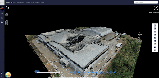
Orthomosaics, 3D models, and annotated damage overviews are processed on a compressed timeline so response teams, claim handlers, and engineers can work from real geometry while the event is still unfolding. Re-capture flights track change where recovery is under way.

05

Signed documentation and handoff

A Pr Eng reviewed and signed record of the site as captured: damage extents, measurable geometry, indexed imagery, and chain-of-custody documentation. From there the engagement hands off cleanly into insurance loss adjusting, forensic engineering, or reinstatement design as needed.

Report an active incident Insurance loss adjusting service
Equipment

What we use.

Calibrated, sector-matched hardware combined with proprietary software. The capture stack is selected for the asset, not the other way around.

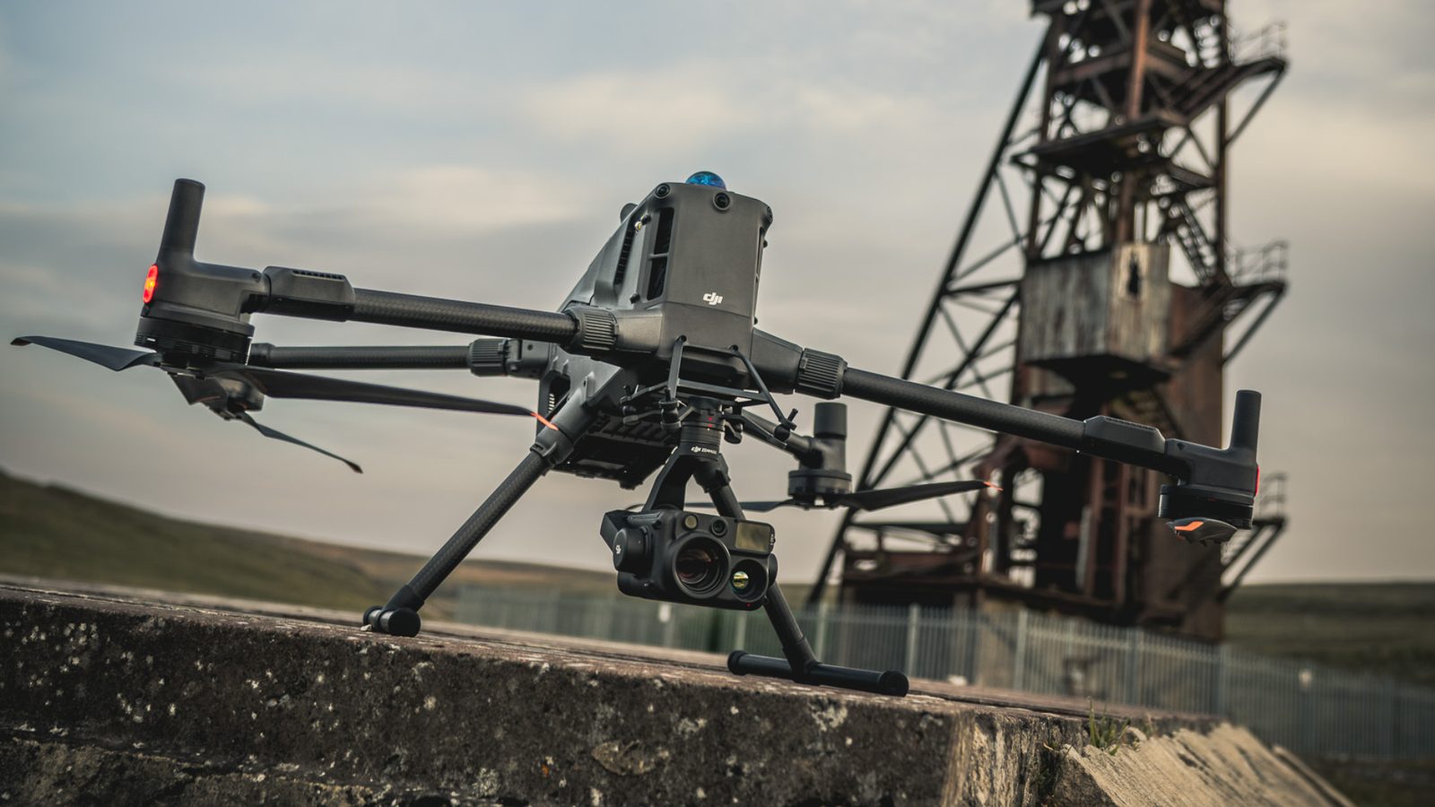
DJI Matrice 400 with Zenmuse H30T

DJI Matrice 400 with Zenmuse H30T

Primary rapid-response aerial capture. Photogrammetry for damage extents, thermal for fire and water mapping, multi-site campaigns at scale.

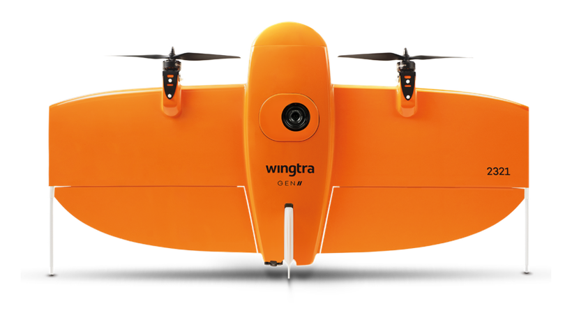
WingtraOne

WingtraOne

Fixed-wing wide-area mapping for flood plains, corridors, and district-scale events where coverage speed matters most.

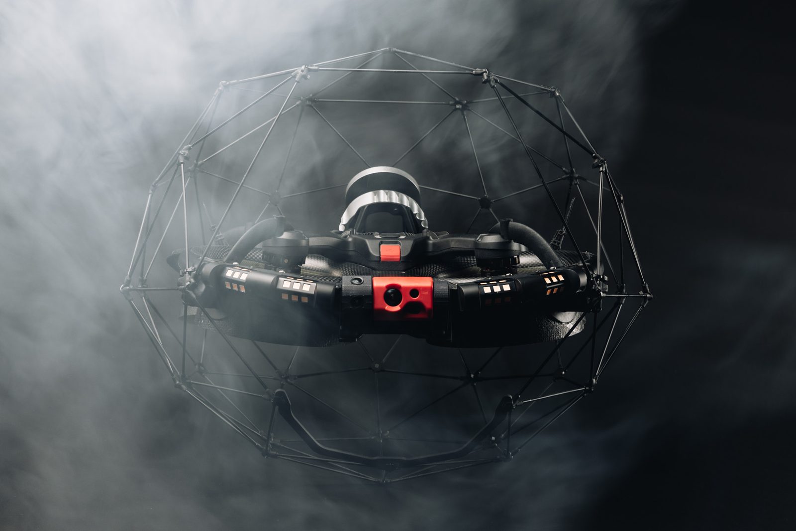
Flyability ELIOS 3

Flyability ELIOS 3

Confined-space capture inside structurally compromised buildings and infrastructure, with no personnel entry into unsafe areas.

Sectors

Where this fits.

The same engineering discipline applies across Insurance and loss adjusting, Public infrastructure and municipalities, Mining and industrial, Commercial property. The detail changes with the asset class and the operational context.

Insurance and loss adjusting

Evidence preservation and damage quantification feeding directly into claim adjustment, reserve setting, and subrogation analysis

Public infrastructure and municipalities

Flood, storm, and failure events on roads, bridges, water infrastructure, and public buildings. Rapid situational mapping for response coordination

Mining and industrial

Tailings and containment failures, plant fires, structural collapses. Baseline capture for regulatory reporting and engineering investigation

Commercial property

Fire, flood, and unrest damage to warehouses, retail, and commercial premises. A consistent record across single or multiple sites

Selected work

Recent engagements.

Specific projects where this service was deployed. Each links to the full case study with metrics, equipment, and outcomes.

FAQ

Frequent questions.

Direct answers to the questions clients ask most often before engaging.

How fast can you be on site?

Within 24 to 72 hours for South African events, depending on location and access. For multi-site events, capture is sequenced by priority with the first sites flown while later sites are still being scoped.

Who typically engages you after a disaster?

Any of the parties who will need the record: the asset owner, the insurance carrier, the appointed loss adjuster, or a public authority. We operate as an independent capture and engineering party, and the same record can serve multiple parties.

Do you interfere with emergency operations?

No. We document, we do not perform rescue or recovery. Capture begins once the responsible authority clears access, and flight operations are coordinated with any air restrictions in effect over the site.

What do we receive in the first week?

Typically an orthomosaic and 3D model of the site, annotated damage overviews, and indexed imagery, delivered through DeltaCloud so response and claim teams work from the same record. The signed engineering documentation follows once analysis is complete.

How does this differ from your loss adjusting and forensic services?

Disaster response is the rapid-capture lane: preserving the record in the first days. Insurance loss adjusting quantifies the loss for the claim. Forensic engineering establishes cause. All three run on the same captured record, so engaging us early means no re-capture later.

Can the capture support litigation or subrogation later?

Yes. Capture sequence and chain of custody are documented from the first flight, and the record is reviewed under Pr Eng oversight. Where causation analysis is needed, our forensic engineering practice works from the same evidentiary record.

Related services

If this fits, these often do too.

Engineering programmes rarely run on a single service. These adjacent capabilities most often pair with the work above.

Accuracy & standards

Built to be signed, not just shared.

Pr EngECSA

Engineering deliverables reviewed and signed by a registered professional engineer.

SAGIsurvey

Geospatial deliverables carry registered land-surveyor sign-off where accuracy must be certified.

Classstated

Every deliverable carries a stated survey accuracy class or BIM level of development (LOD), reported per engagement against check-point analysis.

Standardscited

Findings cross-referenced to the applicable codes (SANS, TMH, EN), with accuracy statements on every report.

Start here

Report an active incident

Send the brief and our engineering team will review your enquiry and reply within one business day. Prefer to talk first? Call or WhatsApp us below.

Response within 1 business day · Pr Eng or SAGI signed

Start a project Call