






Core area 01

Scan to BIM &
3D Digitisation

Precision modelling from the real world. Multi-sensor digital capture, converted into BIM and CAD models you can design against, build from, and submit, accepted by authorities.

Trusted by
Sasol Eskom Impala Platinum Sibanye-Stillwater Afrimat Growthpoint Concor Stefanutti Stocks Zutari Infrastructure South Africa
[01]

The problem
we solve.

Most existing buildings and industrial facilities lack reliable digital records. Original drawings are missing, out of date, or were never accurate. When a refurbishment, retrofit, or compliance submission is needed, teams spend weeks on manual measurement or work from partial information that exposes the project to risk.

Delta Scan closes that gap. We capture the site with calibrated sensors, process the data through proven workflows, and deliver fully referenced BIM and CAD models teams can design, build, and submit from. Our in-house architectural team handles drawing requirements for formal council submissions, so the chain from capture to approval stays with one accountable partner.
[02]

Our
methodology.

Every Scan to BIM engagement follows the same four phases, sized to the project.

  • Phase 1: Scoping and survey plan. Site walk-through, level of development (LOD) agreement, constraint and safety brief, and capture plan. Deliverable: signed survey plan with accuracy targets and control network design.
  • Phase 2: Capture. Terrestrial LiDAR, UAV photogrammetry, and SLAM mobile mapping, selected for the asset and its environment. Control points established via RTK or total station. Typical capture: 1 to 5 days by site complexity.
  • Phase 3: Registration and processing. Point clouds registered, quality-checked against control, classified, and uploaded to DeltaCloud for client review. Typical processing: 2 to 10 days.
  • Phase 4: Modelling and delivery. BIM built in Revit or CAD in AutoCAD to agreed LOD, reviewed by a Pr Eng or registered architect, and delivered via DeltaCloud with all drawings, schedules, and metadata.
[03]

What you
receive.

Deliverables are scoped to your requirements. Typical Scan to BIM outputs include:

  • Registered and classified point cloud (.e57, .las, .laz, .rcp) hosted on DeltaCloud
  • Revit model at agreed LOD (typically LOD 200 to 400)
  • AutoCAD 2D drawings: plans, elevations, sections, details
  • As-built documentation for handover or facilities management
  • Clash detection reports between existing conditions and proposed design
  • Deflection and deformation analyses where structural verification is required
  • Council and authority submissions drafted by the in-house architectural team
  • Ortho-imagery and photorealistic 3D meshes where visualisation is required
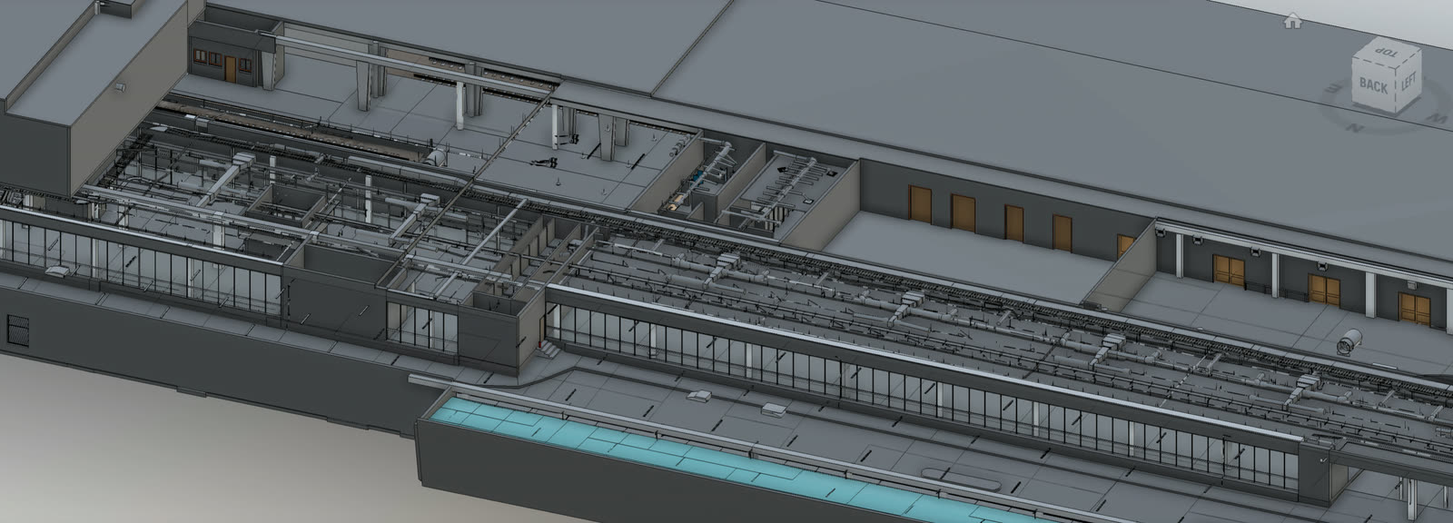
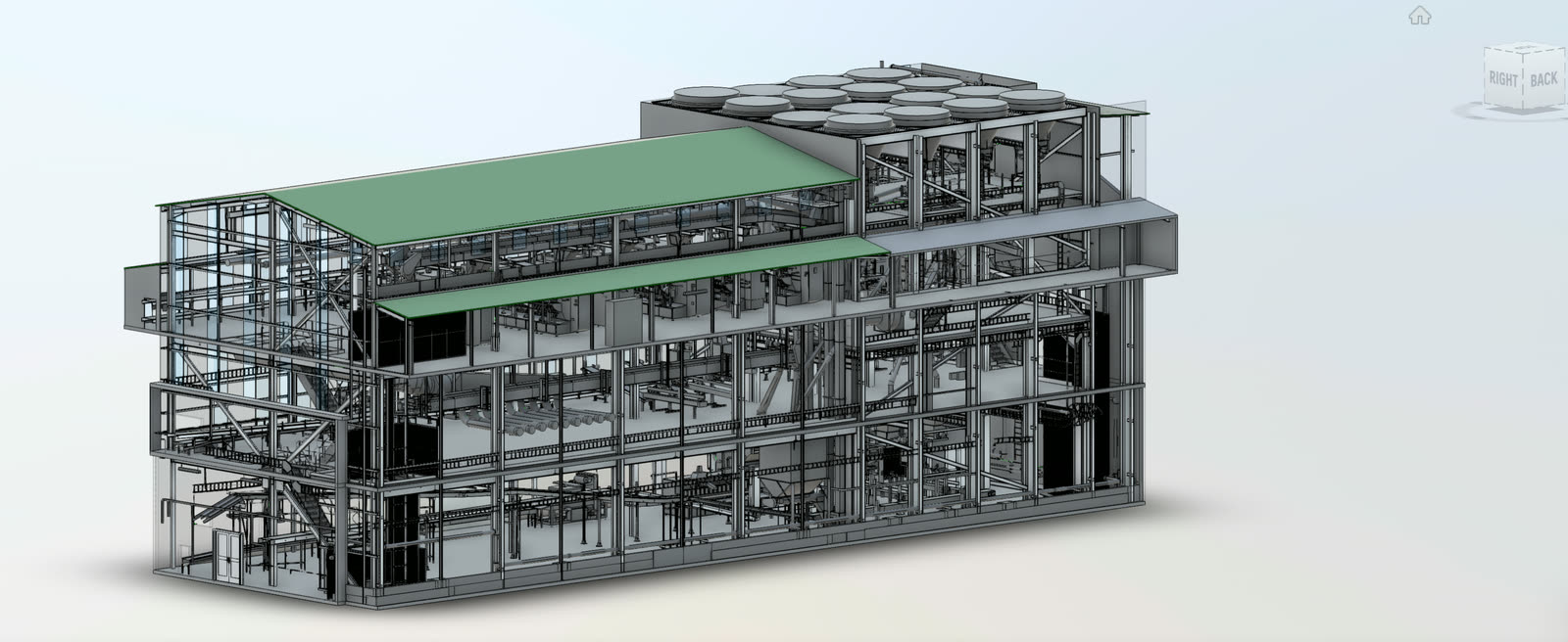
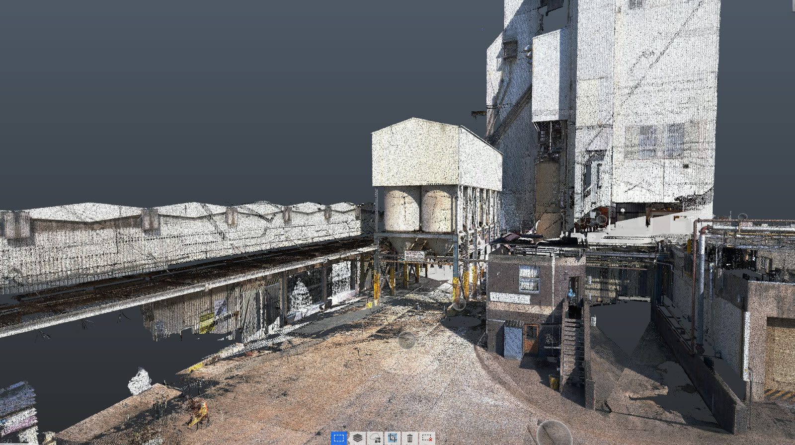
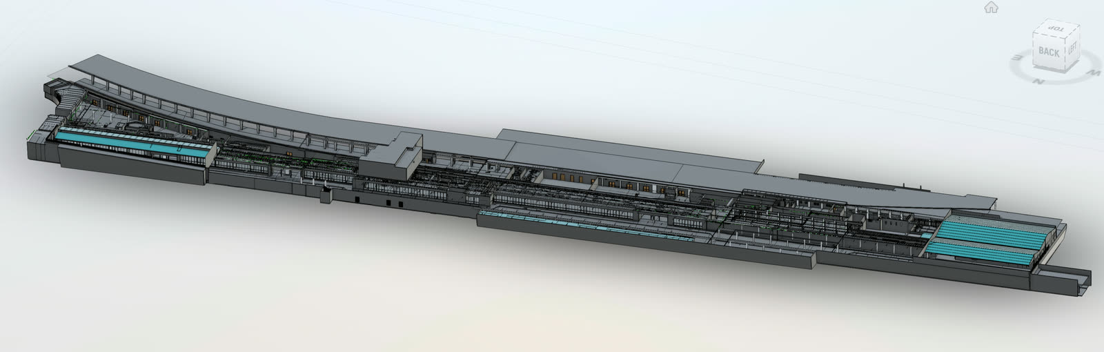
Selected output

Capture, rendered as a model.

Real point-cloud captures and the federated BIM models built from them. Every model is dimensionally tied to control and Pr Eng reviewed before release.

[04]

Equipment
& standards.

Equipment

  • NavVis VLX3 wearable mobile mapping for rapid indoor and outdoor capture with 6mm range accuracy
  • Terrestrial LiDAR scanners for millimetre-grade static capture
  • DJI M350 RTK UAV with L2 LiDAR or P1 photogrammetry payload for external envelope and roofscape
  • Lixel K1 handheld SLAM LiDAR for complex or confined areas
  • Total station and RTK GPS for control network establishment

Standards & compliance

Models conform to ISO 19650 information management principles and BIM Level 2 collaboration workflows. Architectural drawings follow SANS 10143 and local municipal submission requirements. Every model includes metadata, coordinate references, and accuracy statements suitable for engineering and legal purposes, reviewed by a Pr Eng and, where relevant, a registered architect before release.

[05]

Where
it applies.

  • Heritage buildings requiring accurate digital records before refurbishment
  • Industrial plant and refineries where retrofit design depends on precise as-built information
  • Commercial and residential buildings for change of use submissions
  • Mine surface infrastructure and processing plants for expansion or compliance work
  • Transport infrastructure requiring documentation for maintenance and future works
  • Insurance and compliance scans where legally defensible records are required
[06]

Questions
we hear often.

Straight answers to the questions clients ask most before engaging us.

How accurate are your models?
Typically sub-centimetre for structural members in a Revit model, with the point cloud registered to better than 10mm against control. Higher accuracy is available where the application requires it, scoped in the survey plan.
How long does it take?
A 2,000 square metre two-storey office capture typically delivers a Revit model within three to four weeks of site access. Larger industrial facilities scale from there.
Do you operate outside South Africa?
Yes. From our Johannesburg HQ, our 100+ capture partner network extends field reach across the Middle East, SADC, and the broader African continent · with Delta Scan providing the engineering review and Pr Eng sign-off where we are the engineer of record.
Can you work with our existing BIM team?
Regularly. We provide capture and modelling and hand off in your preferred schema, or run full BIM coordination if that is the scope. If you are an engineering firm wanting capture and tooling under your own authority, see For Engineering Firms.
Inside the data

The measurable basis under every model.

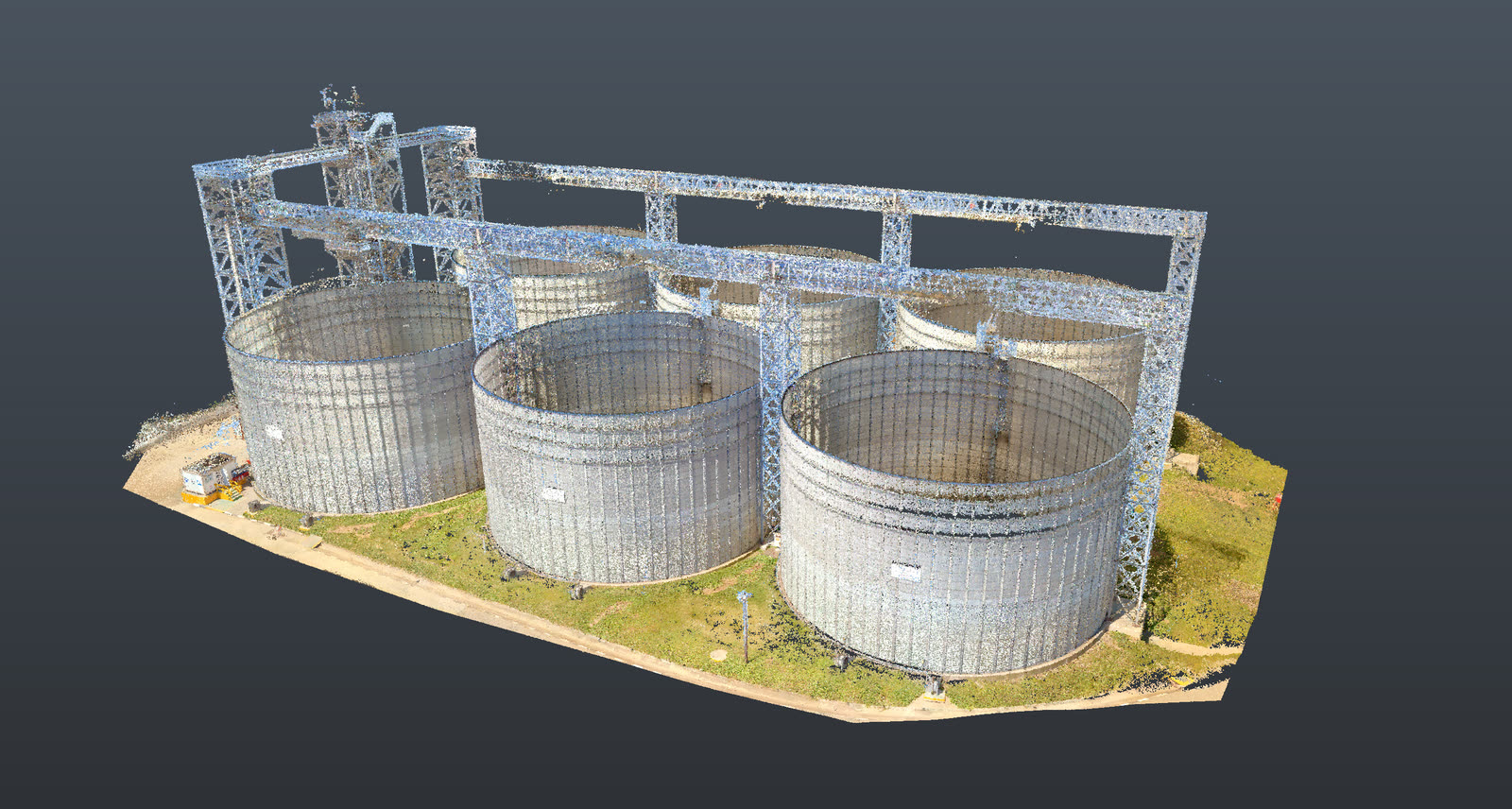
A registered survey-grade point cloud of a silo array and steel gantry, georeferenced to a single common datum Survey-grade registrationMeasurable in the browserSingle common datum
A registered point cloud: georeferenced to a single common datum and ground control, every member measurable to the accuracy class the engineering decision requires.
Accuracy & standards

Built to be signed, not just shared.

Pr EngECSA 202001436

Every engineering deliverable is reviewed and signed by Darryl Epstein, a registered Professional Engineer (Pr Eng, ECSA 202001436).

SAGIsurvey

Geospatial deliverables carry registered land-surveyor sign-off where accuracy must be certified.

Classstated

Every deliverable carries a stated survey accuracy class or BIM level of development (LOD), reported per engagement against check-point analysis.

Standardscited

Findings cross-referenced to the applicable codes (SANS, TMH, EN), with accuracy statements on every report.

Start here

Start a Digitisation and Scan to BIM engagement

Send the brief and our engineering team will review your enquiry and reply within one business day. Prefer to talk first? Call or WhatsApp us below.

Response within 1 business day · Pr Eng or SAGI signed

Start a project Call