




Specialised Service

Ore Pass Inspection

Drone-based 3D inspection of mine ore passes. Wear profiling, blockage assessment, hang-up risk evaluation, and design verification using the Flyability ELIOS 3 caged drone and our Shaft Analyser processing pipeline.

Trusted by
Sasol Eskom Impala Platinum Sibanye-Stillwater Afrimat Growthpoint Concor Stefanutti Stocks Zutari Infrastructure South Africa
In short

Ore pass inspection measures wear, blockage risk, and geometry inside mine ore passes and raise bores. Delta Scan uses collision-tolerant drones and LiDAR to build a 3D model for cross-sections, tolerance checks, and rehabilitation planning, with no one entering the excavation.

Ore passes are critical infrastructure in deep-level mining: they connect levels, regulate material flow, and absorb a substantial portion of the mechanical wear from rock movement. They are also genuinely dangerous to inspect. Hang-ups, secondary breakage, water accumulation, and gradual wall erosion progressively change the geometry, and a worn or partially blocked ore pass can fail catastrophically.

Conventional inspection methods rely on visual assessment from collar or sub-collar with a torch and rope-suspended camera. Coverage is poor, the data is qualitative, and the practical depth limit is shallow. Delta Scan deploys the Flyability ELIOS 3 caged drone for full 3D capture of operational ore passes. The resulting point cloud reveals wear profiles, blockage geometry, hang-up locations, and design-versus-as-built deviation in a single survey.
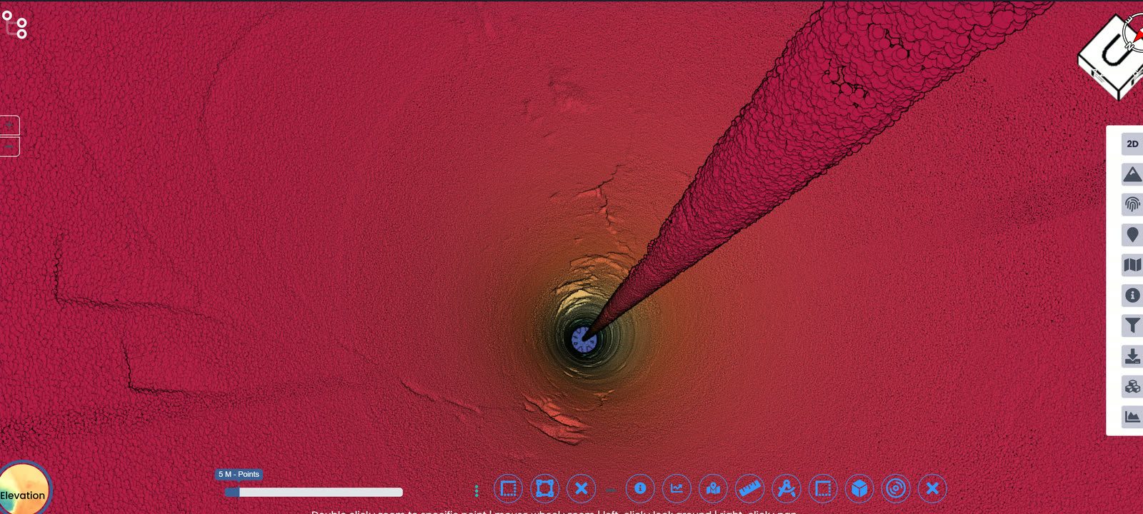
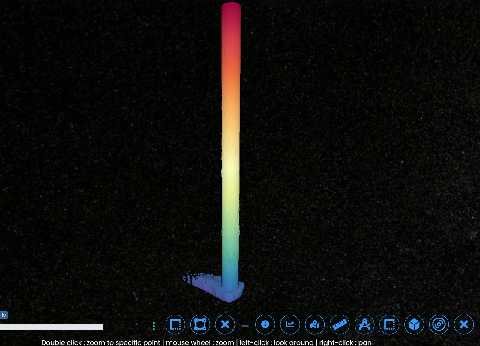
Selected output

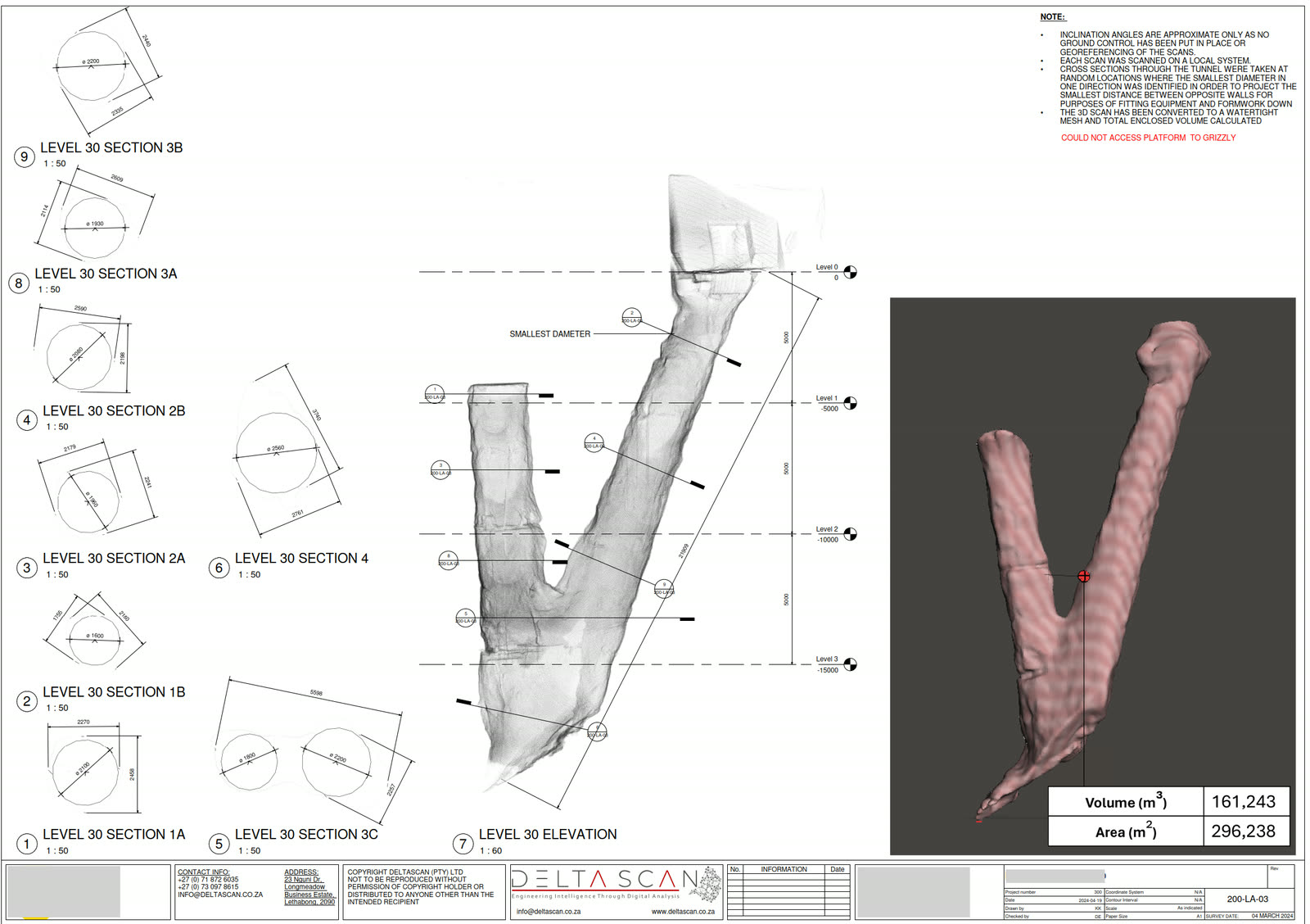
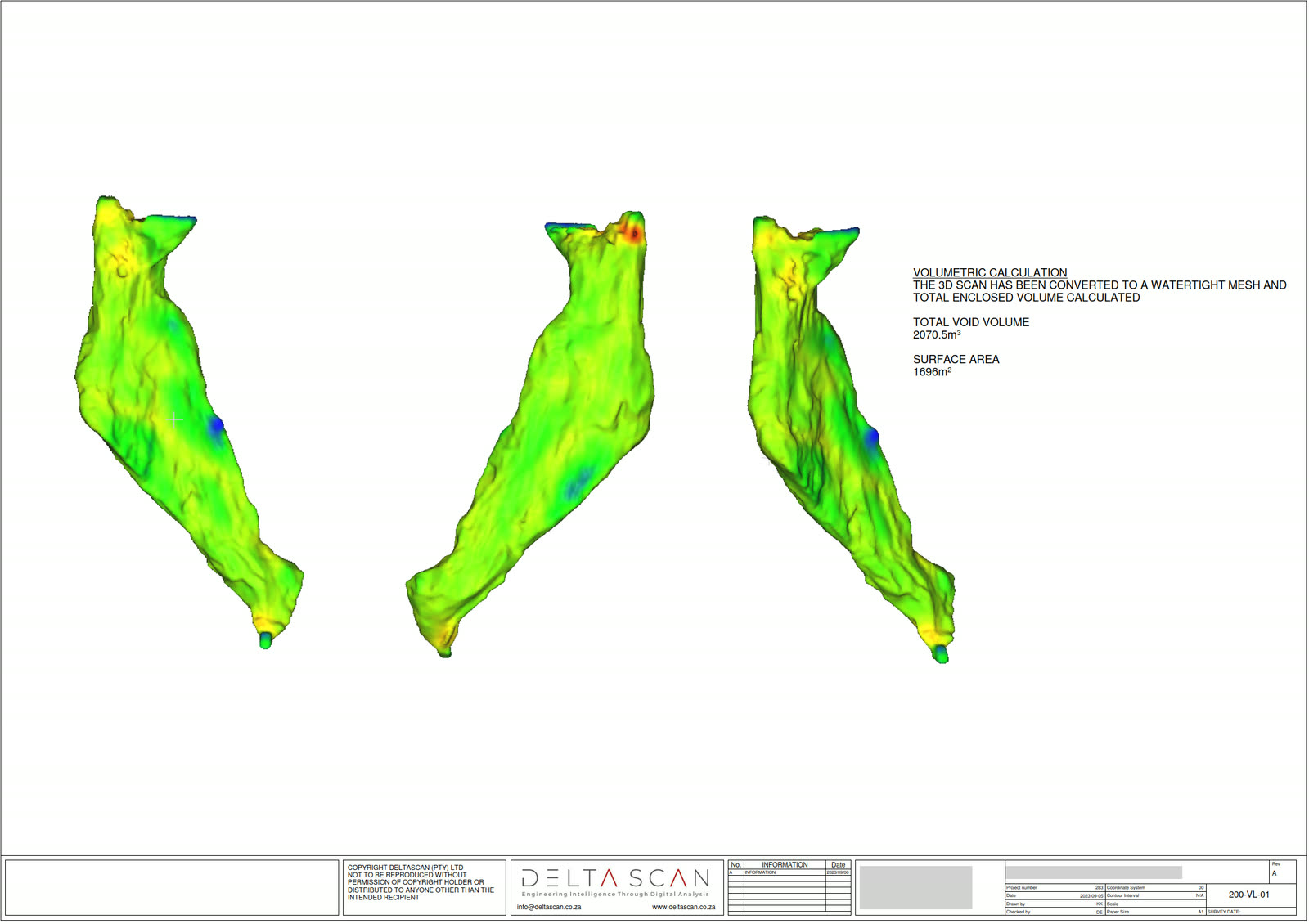
Ore passes, quantified.

Drone and LiDAR capture of ore passes and raise bores, reconstructed into cross-sections, tolerance checks, and volumes.

When to use it

Typical engagements.

Each scenario below represents a real-world trigger for this service. If your situation matches one of these, get in touch.

Routine wear surveys

Scheduled condition assessment of high-throughput ore passes. Quantifies wall wear, identifies emerging hang-up risks, and tracks rate of section change over time.

Pre-clearance assessment

Before blockage clearance work, drone capture establishes the precise geometry and material distribution. Allows clearance planning that does not rely on inference from above.

Design verification

Post-construction or post-rehabilitation, a 3D scan confirms the ore pass matches the design intent. Identifies any inaccuracies in raise boring trajectory or lining placement.

Investigation and forensic

After a fall-of-ground event, water inrush, or unexpected hang-up, a controlled drone survey establishes what happened without sending personnel into a destabilised structure.

How it works

Our process.

A repeatable five-stage workflow. The same disciplined sequence runs whether the site is a 500-hectare mining operation or a single 60-metre bridge.

01

Operational risk assessment

Mine standards govern ore pass entry. Pre-deployment risk assessment covers material flow status, water level, ventilation, electrical, and emergency egress. Deployment only proceeds with explicit Section 21 sign-off and ore pass access permit.

02

Collar deployment

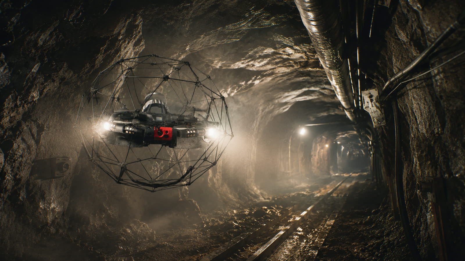
The ELIOS 3 is launched from the ore pass collar or from an adjacent level. Its protective cage permits controlled contact with the pass wall, enabling tight manoeuvring even in restricted geometry.

03

SLAM capture

The drone descends through the ore pass capturing 360-degree LiDAR and camera data. SLAM constructs the 3D model in real time. Operators can guide the drone toward specific areas of interest such as suspected hang-up locations.

04

Processing and analysis

Shaft Analyser processes the SLAM data with drift correction. Wear profiles are extracted by sectioning the point cloud at regular intervals. Cross-sections are compared against design or previous epoch geometry.

05

Engineering deliverable

A signed report including 3D point cloud, level-by-level cross-sections, wear contour plots, identified hang-up risk locations, and recommended remedial or monitoring actions.

Request an ore pass inspection See our mining work
Equipment

What we use.

Calibrated, sector-matched hardware combined with proprietary software. The capture stack is selected for the asset, not the other way around.

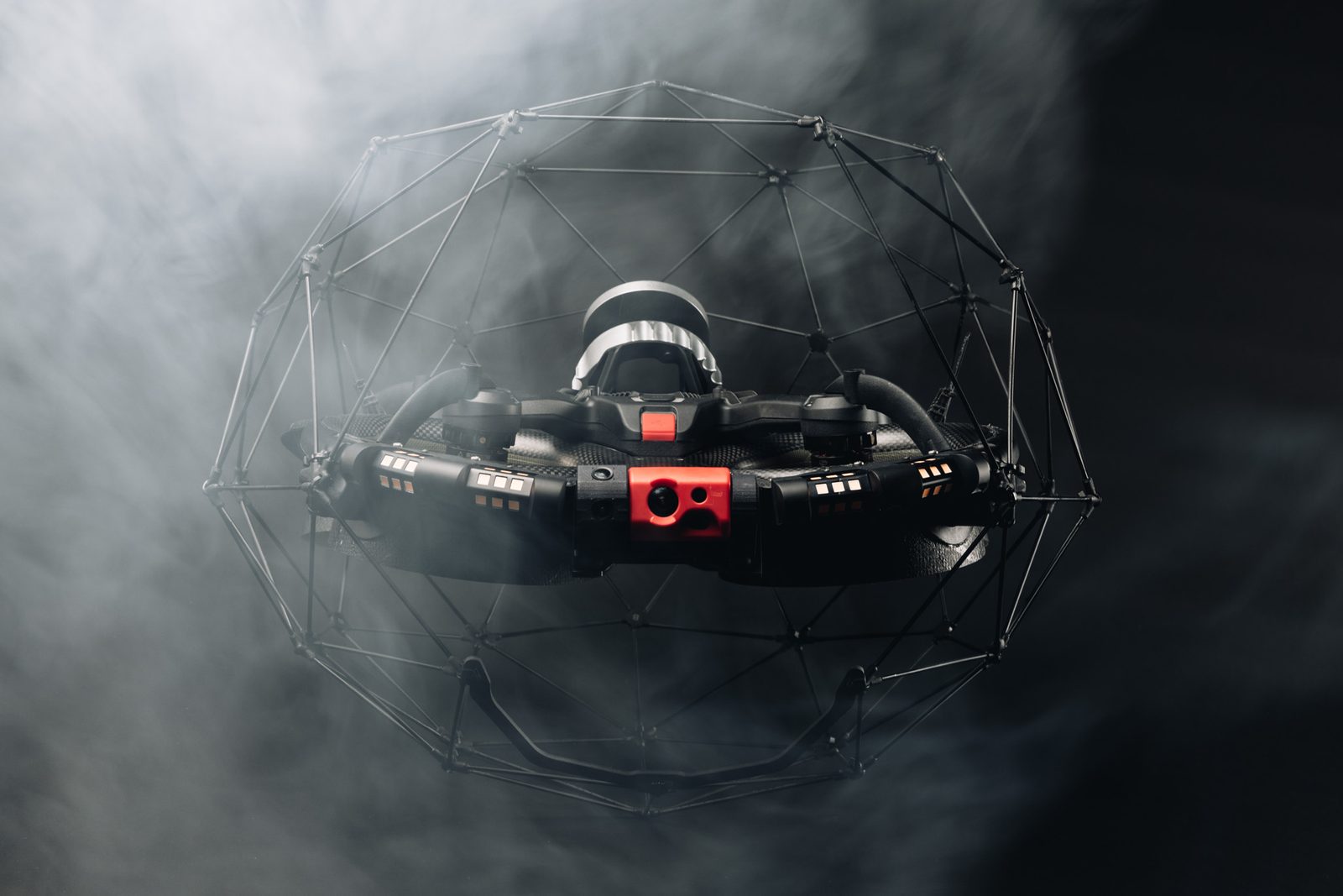
Flyability ELIOS 3

Flyability ELIOS 3

Caged inspection drone designed for confined-space deployment. Tolerant of contact with ore pass walls. Integrated LiDAR and HD cameras.

Shaft Analyser pipeline

Shaft Analyser pipeline

Processing the SLAM capture into corrected, geolocated 3D models with cross-sectional analysis and wear quantification.

Sectors

Where this fits.

The same engineering discipline applies across Deep-level gold, Platinum, Copper and base metals, Construction and rehabilitation contractors. The detail changes with the asset class and the operational context.

Deep-level gold

High-throughput ore passes in Witwatersrand and Free State operations, including passes serving multiple levels

Platinum

Bushveld Complex ore pass systems supporting mechanised extraction

Copper and base metals

Bulk-mining ore pass infrastructure

Construction and rehabilitation contractors

Pre-construction surveys for raise-bored or excavated new passes, and post-rehabilitation verification

FAQ

Frequent questions.

Direct answers to the questions clients ask most often before engaging.

Can you inspect a wet ore pass?

Yes, subject to assessment of water level and current. The ELIOS 3 is IP54 rated and can operate in dusty and lightly wet conditions. Heavily flooded passes require dewatering first.

How long does an ore pass inspection take?

Field deployment for a single ore pass is typically half a shift to one full shift. Processing and reporting add three to five working days.

What is the cost compared to manual visual inspection?

Drone inspection is typically two to three times the unit cost of a visual collar inspection, but provides full-coverage quantitative data instead of partial qualitative observation. The economic case is strongest where blockage clearance or rehabilitation decisions depend on the quality of the inspection data.

Can the drone get stuck in the ore pass?

It is a real risk on any confined-space deployment, mitigated by the cage design, operator skill, and tether systems on certain configurations. Loss-of-equipment protocols are part of every job risk assessment.

Do you provide the engineering recommendation?

The drone capture and 3D model is delivered under our standard process. Recommendations on clearance methodology, lining design, or operational restrictions are made by a registered professional engineer where they fall within our scope, or handed back to your own engineering team or appointed engineer of record where you prefer to keep that decision in-house.

Related services

If this fits, these often do too.

Engineering programmes rarely run on a single service. These adjacent capabilities most often pair with the work above.

Accuracy & standards

Built to be signed, not just shared.

Pr EngECSA 202001436

Every engineering deliverable is reviewed and signed by Darryl Epstein, a registered Professional Engineer (Pr Eng, ECSA 202001436).

SAGIsurvey

Geospatial deliverables carry registered land-surveyor sign-off where accuracy must be certified.

Classstated

Every deliverable carries a stated survey accuracy class or BIM level of development (LOD), reported per engagement against check-point analysis.

Standardscited

Findings cross-referenced to the applicable codes (SANS, TMH, EN), with accuracy statements on every report.

Start here

Request an ore pass inspection

Send the brief and our engineering team will review your enquiry and reply within one business day. Prefer to talk first? Call or WhatsApp us below.

Response within 1 business day · Pr Eng or SAGI signed

Start a project Call