





Specialised Service

Ship and Vessel Hull Inspection

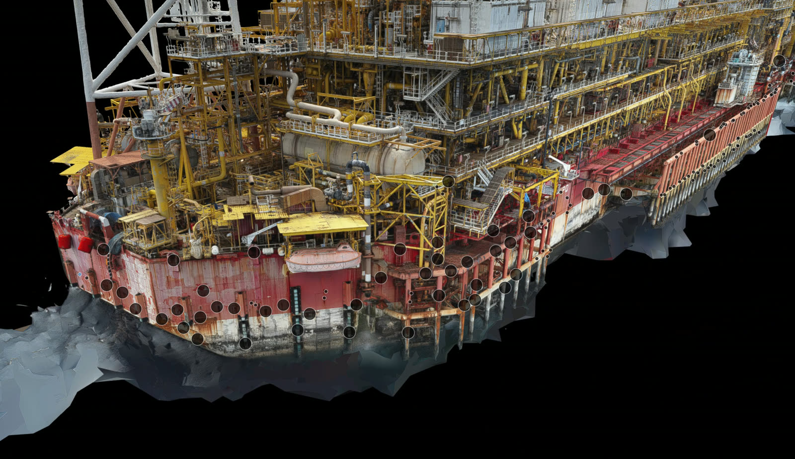
Hull, topsides and structure captured without staging or extended downtime. Corrosion, coating breakdown and structural defects recorded against position, severity rated, and delivered as a navigable 3D record your class surveyor and your maintenance planners can both work from.

Trusted by
Sibanye-Stillwater Eskom Grindrod Debswana TotalEnergies

Inspecting a vessel is a logistics problem before it is an engineering one. Staging, rope access and confined-space entry are slow, expensive and carry real risk, and the traditional output is a folder of photographs whose location on the vessel is recorded only in the surveyor notes. When the same defect is revisited a year later, nobody can be certain it is the same defect.

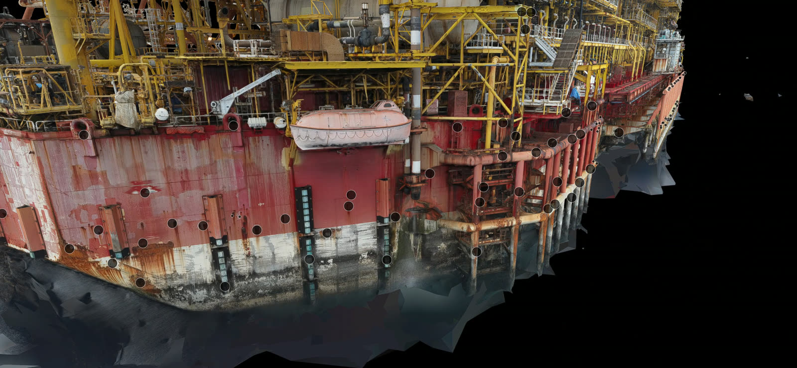
Delta Scan captures the vessel instead of photographing it. Drone capture handles the hull sides, topsides, structures and areas that would otherwise need staging, while internal spaces are captured with in-house 360 technology. Every defect is recorded against its position on a 3D reconstruction of the vessel, so the record is navigable, comparable between inspections, and reviewable by people who were never on board. Our showcase engagement is a full integrity audit of an FPSO offshore West Africa, covering the hull, all process modules, the flare structure and the heli deck.
When to use it

Typical engagements.

Each scenario below represents a real-world trigger for this service. If your situation matches one of these, get in touch.

Class and statutory survey preparation

Capture the vessel before the surveyor arrives, so the survey is spent on assessment rather than on discovery, and so any defect found has a documented position and history.

Coating condition and corrosion assessment

Full-area coating breakdown mapping across hull and topsides, quantified and located, rather than described. The basis for scoping a blast and paint campaign accurately instead of by allowance.

Dropped object survey and structural integrity

Systematic dropped-object surveys of elevated structures, and structural condition assessment of modules, supports and flare structures where access is the limiting factor.

Damage assessment and repair scoping

After contact damage, heavy weather or a fire, an accurate measured record of the affected structure supports the repair specification and the insurance position.

How it works

Our process.

A repeatable five-stage workflow. The same disciplined sequence runs whether the site is a 500-hectare mining operation or a single 60-metre bridge.

01

Scope, access and permits

We agree the extent to be inspected, the standards the reporting is written against, and the permit and simultaneous-operations constraints that will govern capture on a live vessel.

02

External capture

Hull sides, topsides, superstructure, flare and elevated structures are captured by drone at close standoff, covering areas that would otherwise require staging or rope access.

03

Internal capture

Internal spaces, tanks and modules are captured with in-house 360 technology, giving continuous coverage of spaces rather than isolated photographs.

04

Defect identification and severity rating

Corrosion, coating breakdown, deformation, piping condition and dropped-object risks are identified, located on the model, and severity rated against the agreed criteria.

05

Digital twin and reporting

You receive a navigable 3D digital twin with a virtual walkthrough, a detailed condition report, severity ratings, and a prioritised action list for repair planning.

Request a hull inspection scoping call See ROV inspection
Equipment

What we use.

Calibrated, sector-matched hardware combined with proprietary software. The capture stack is selected for the asset, not the other way around.

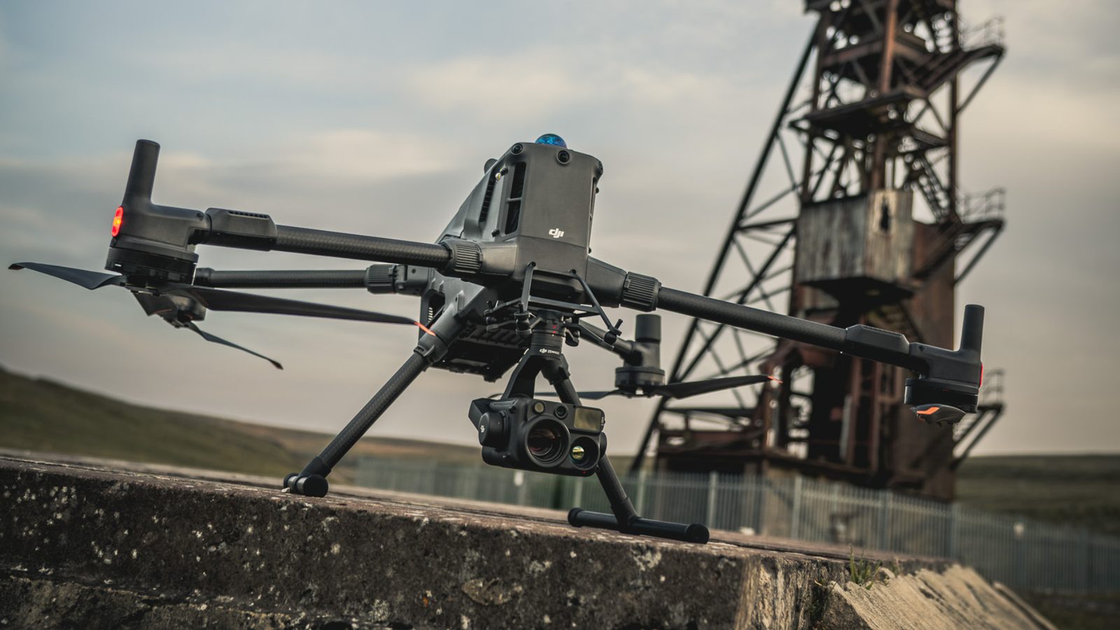
DJI Matrice 400

DJI Matrice 400

External hull, topsides and elevated structure capture at close standoff without staging

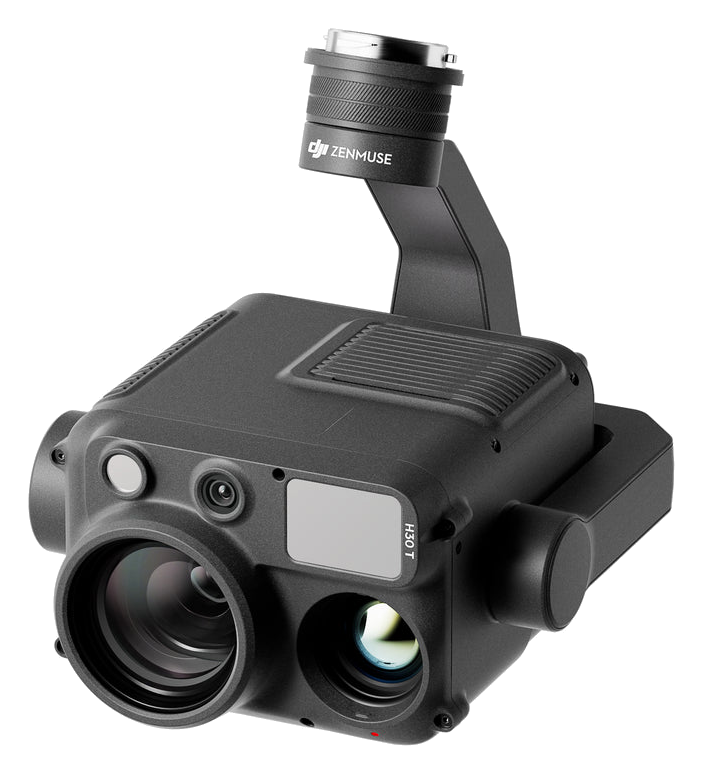
DJI Zenmuse H30T

DJI Zenmuse H30T

High-resolution visual and thermal payload for coating breakdown and corrosion detail

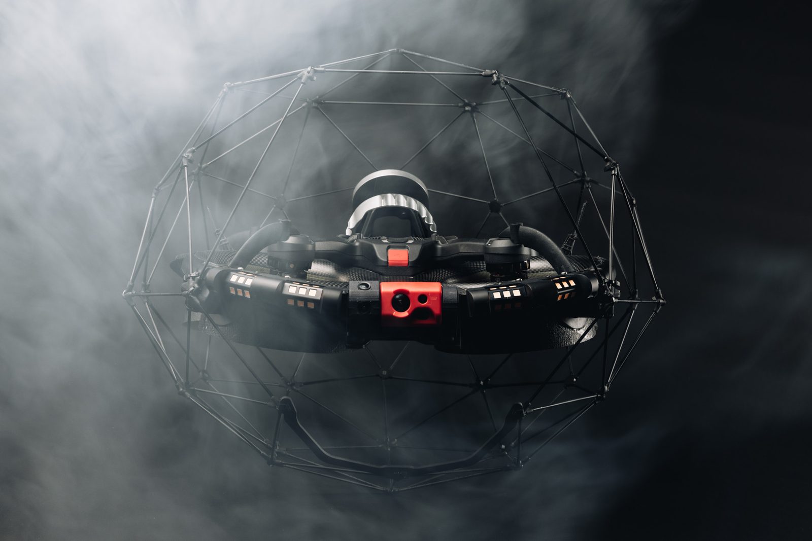
Flyability ELIOS 3

Flyability ELIOS 3

Collision-tolerant capture inside tanks, voids and confined internal spaces where entry is restricted

Sectors

Where this fits.

The same engineering discipline applies across Offshore production, Commercial shipping, Ports and harbour craft, Marine insurance and adjusting. The detail changes with the asset class and the operational context.

Offshore production

FPSO and platform integrity audits covering hull, process modules, flare structures and heli decks on live production assets.

Commercial shipping

Hull and superstructure condition records for class preparation, coating campaigns and charter condition disputes.

Ports and harbour craft

Condition assessment of tugs, barges and workboats, and of quay-side structures alongside them.

Marine insurance and adjusting

Independent measured records of damage extent and pre-existing condition where liability or quantum is contested.

FAQ

Frequent questions.

Direct answers to the questions clients ask most often before engaging.

Can you inspect below the waterline?

Yes, where a submerged inspection is in scope we deploy ROV for below-waterline hull, running gear and structure. Note that our FPSO engagement offshore West Africa was an above-water scope, so the two capabilities should not be conflated when assessing that project as a reference.

Does the vessel need to be out of service?

Usually not. External drone capture is non-contact and is planned around simultaneous operations. Internal capture is scheduled against space availability and permit conditions. Avoiding staging is normally where the time and cost saving comes from.

Do you issue class certificates?

No. We are not a classification society. Our reporting is written against the class and ISO requirements relevant to the asset so that it supports the class process, but the certificate is issued by the class society, not by us.

How is this better than a photographic survey?

A photograph records that a defect exists. A positioned capture records where it is, at what scale, and in a form that can be compared against the same location at the next inspection. That comparability is what turns inspection data into a maintenance trend rather than a snapshot.

Can our own team review the results without specialist software?

Yes. The digital twin and virtual walkthrough are designed to be navigated by maintenance planners, class surveyors and management without training, alongside the written report.

Related services

If this fits, these often do too.

Engineering programmes rarely run on a single service. These adjacent capabilities most often pair with the work above.

Accuracy & standards

Built to be signed, not just shared.

Pr EngECSA 202001436

Every engineering deliverable is reviewed and signed by Darryl Epstein, a registered Professional Engineer (Pr Eng, ECSA 202001436).

SAGIsurvey

Geospatial deliverables carry registered land-surveyor sign-off where accuracy must be certified.

Classstated

Every deliverable carries a stated survey accuracy class or BIM level of development (LOD), reported per engagement against check-point analysis.

Standardscited

Findings cross-referenced to the applicable codes (SANS, TMH, EN), with accuracy statements on every report.

Start here

Request a hull inspection scoping call

Send the brief and our engineering team will review your enquiry and reply within one business day. Prefer to talk first? Call or WhatsApp us below.

Response within 1 business day · Pr Eng or SAGI signed

Start a project Call